A lot can happen in a week when you’re on the road. This time, the end came. The end to this chapter at least. I’m technically “off the road” for the winter, arriving near Bisbee, Arizona last night. My most recent post had me not even in California yet. The only thing to do is try for a Cliff Notes version, in which I visit my storage, visit the San Francisco Bay, double-back to the Sacramento Valley, then try to work my way south without hitting the same ol’ roads.

Homeward bound but homeless
I spent a few days in Klamath Falls visiting friends before making tracks down Hwy 97 towards Reno and Carson City. I like the route but have “been there, done that.” At my storage unit I had a realization: I don’t know this guy. Other than the motorcycles (most of which are under tarps or covers) I don’t recognize this stuff. This is from a previous life — a different person.
I grabbed a few light jackets that I forgot I had, grabbed some plain-white Tees, and dropped off a few trinkets. I also looked for some things and couldn’t find them; I no longer remember this place. It used to be my main “save house;” like in a video game where you stop in to save the game, re-equip yourself, or let the character recover from injury.
I have save-houses all over the US, and kind of live my life like a low-key video game, swapping things out, upgrading things, exploring new areas. The main difference is you don’t run into non-player characters (NPC’s) that send you on quests and reward you with cool weapons and armor and stuff. Too bad there’s not a real-life version of that.
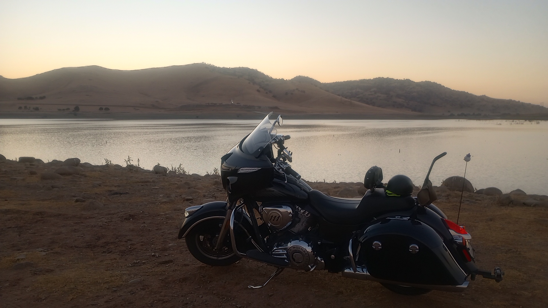
Anyway, I over-nighted at a youth hostel in South Lake Tahoe and tried to get some sleep. In the morning I took an alternate route to the San Francisco Bay area: Hwy 88. Usually you’d take I-80 or Hwy 50, which generally parallel each other until reaching Sacramento. 88 only added about 20min to the total time and is far more scenic too, and doesn’t go through a pass named after pioneers who turned to cannibalism to survive a harsh winter.
Californians are generally terrible at using turn-outs on mountain roads, and today was no exception. I still managed to enjoy myself on the trip over the SIerra’s, then settled into the slog across the central valley. I got into the Bay ahead of commuter traffic, and spent a few days with my friend Sean. We met on the Veteran’s Charity Ride in 2017: my first time as sidecar pilot for the photog and Sean as an embedded journalist for Military.com.
That means we’re both veterans, motorcyclists, and writers, on top of both serving in the aviation field (him with Harriers, me with Blackhawks). I tried to get a new ID card at the VA while there but ran into red tape. I did get a prescription filled, and also swung through the local Indian dealership and looked at bikes, including other brands like Moto Guzzi and Royal Enfield.
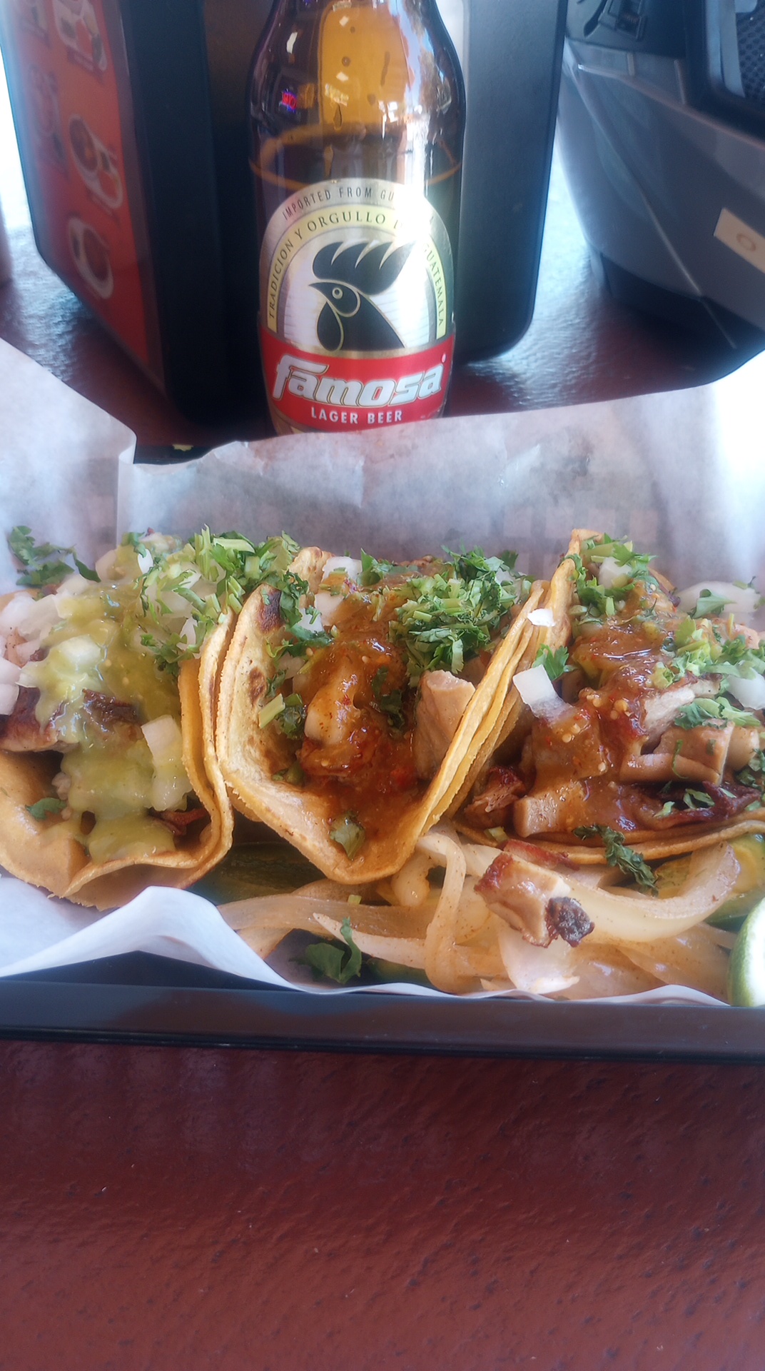
Coming back from there Sean asked me at a stoplight, “you wanna get some tacos?” Hell, this guy definitely has more than just a little in common with me.
Sierra mountain retrograde
After that I went back east towards Sacramento. I stopped off at the Mountain View Cemetery in Oakland though. I’ve been there several times because not only is it beautiful and full of Civil War veterans, but it has the urn of George A. Wyman in its columbarium. He was the first person to motor across the US back in 1903, but was rather quickly cast aside after the first automobile did it a year later.
I was happy to see the quarter I left last year was still there and that someone had left flowers as well. However, I was stopping in because I found another famous grave I was unaware of. In section 51 (coincidentally adjacent to the columbarium) was the grave of Shrimp Burns. Born Albert Burns in 1898, he was racing in his native California at age 15.
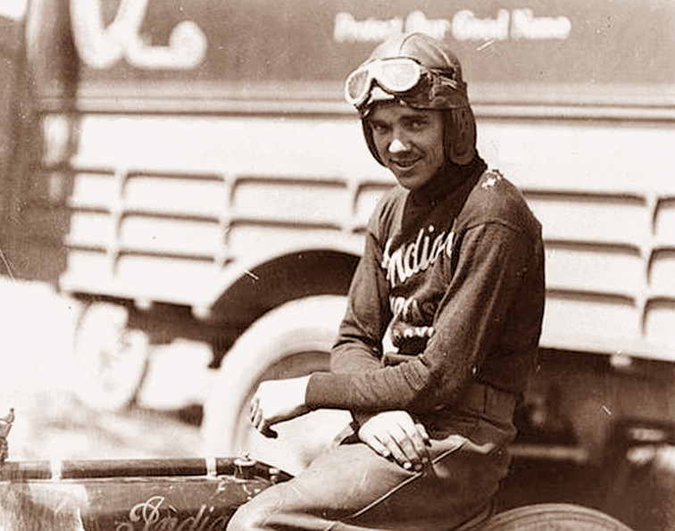
When he was legal to go national (18yo) he signed with Harley-Davidson and won them a national championship. With older racers coming back from WW1 he felt a bit overshadowed at Harley and didn’t get along with the team’s Captain, AMA Hall-of-Famer Otto Walker, so he made the unheard of move of signing with Indian Motorcycle. The rivalry between the two manufacturers was so strong back then, you simply didn’t switch sides.
Burns went on to win a lot of races and set a lot of records, but didn’t get another national championship. His first year at Indian saw too many mechanical failures despite several wins, and the following year Burns was practicing for a race in Toledo, Ohio, when he struck another rider and crashed into the outer barrier (which was only a railing like at horse tracks, common at the time). He died of head injuries later that day.
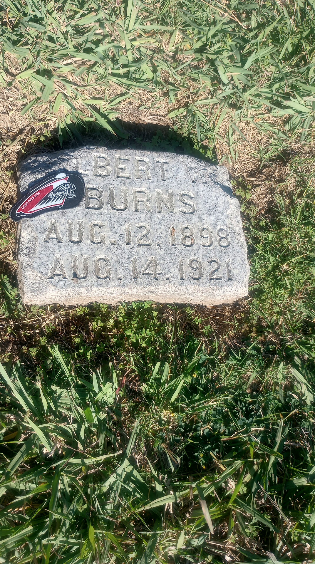
I left a memento the dealership gave me at his grave and said a few words. I very much believe that speaking the names of the dead and telling their story keeps them alive in a way. After visiting his and Wyman’s graves I was off to Sacramento, where my buddy from the Marines summarily flaked on me while I was en route.
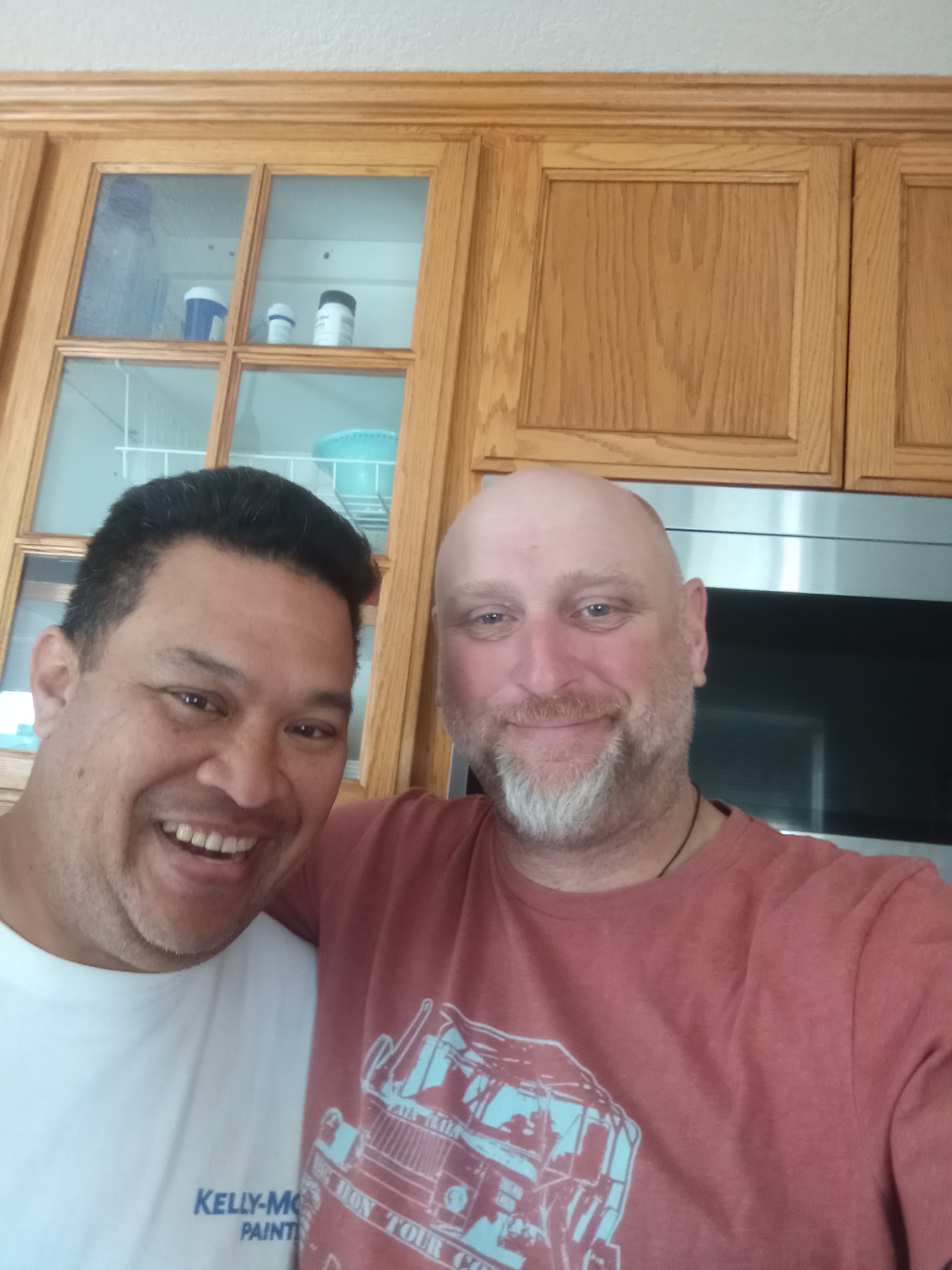
Fortunately the next person I was to visit only lived about 30min outside Sacramento, and he was ready to receive me a day early. This is my brother-from-another-mother Cyrus, who I’ve known since the 8th grade. Despite being close friends, we both got into the military and motorcycling on our own, but can share both along with our “back in the day” memories.
He went the family route and his oldest went off to Navy boot camp recently. The other two are younger, with his daughter bearing the middle name “Johnnie” as wink to me. Needless to say, his wife Jess treats me like family and I always feel welcome. Outside of blood relatives, Cyrus might be the only person who has chosen to love me even when it isn’t convenient. That is rare and extremely special to me.
The final leg is a long one
After a few days catching up with Cy it was time to head south to Bisbee. I chose Highway 49 for the first part, refusing to use the interstate or Hwy 99… 395 either. So south I went into some of the Gold Country. Angel’s Camp is a popular destination for bikers, but there was little other motorcycle traffic on a weekday. 49 also takes you through Calaveras County, if you’re familiar with the Mark Twain story. There is also a replica cabin of his in the area, but I’ve stopped and seen it before so I just passed on by.
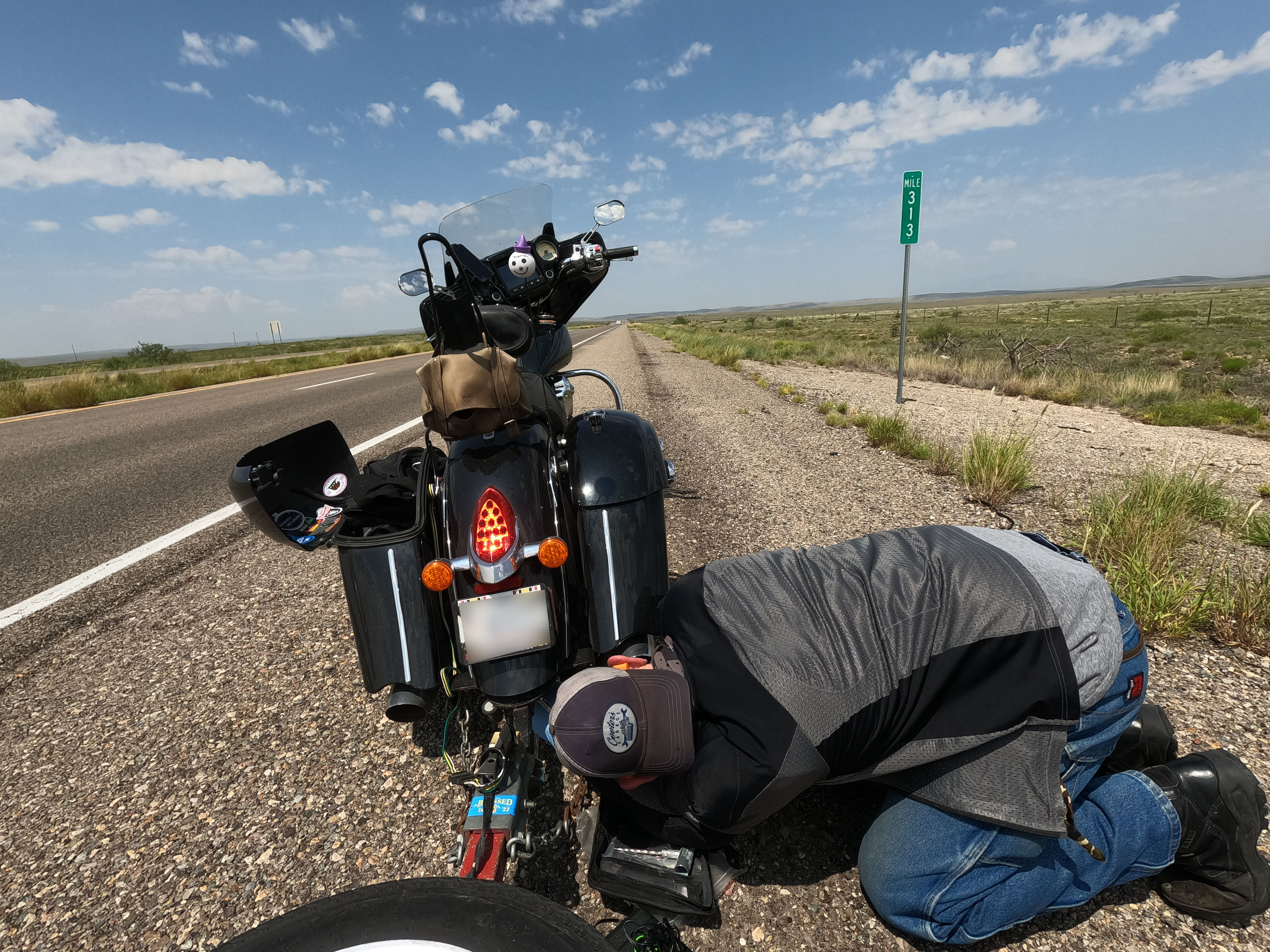
South of there I noticed a really weird sound, kind of like a squeak or howl, coming from the bike. It was faint and disappeared below about 50mph, and I wasn’t getting above 50mph very often with all the turns. When I heard it a 2nd time I knew it wasn’t something I’d heard before, so I pulled over.
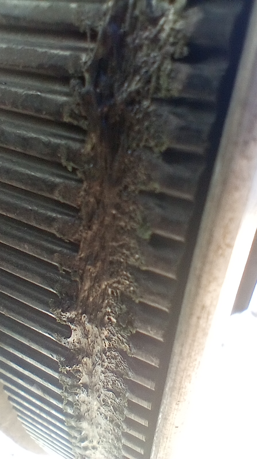
I couldn’t find anything but a check of the drive belt showed a really bad gouge along its outer circumference. I couldn’t see anything untoward so I jacked the rear tire off the ground and spun the wheel backwards to inspect the damage. That’s when a rock came around, still embedded in the rubber. Imagine if I had kept going? The damage was back but but didn’t go into the Kevlar, or damage the inside where the teeth meet the pulleys.
Right then, back on the road. And what a road. This is still Brown-Town, full of dead grass on rolling hills, but you’re close enough to the Sierras to hit sections of foothills with evergreen trees.
The road goes from great to epic south of Coulterville, but that’s also where I ran into more problems…the rear tire. Again.
The tire plug was still in place, but the hole was starting to split and it was leaking. I decided to add the last of my Slime and found out my air pump wasn’t working. The motor ran, but it wouldn’t put air in the tire. I tried replacing the valve core. I tried to break open the valve on the air pump to make sure it wasn’t leaking. I even wrapped it in F4 tape and just couldn’t get it to fill.
Someone finally stopped and it seemed the only option was to ride with him 40min to Mariposa, get a new pump at an auto parts place, and head 40min back to the bike. At least he was willing. Getting back to the bike and in the last of the daylight, the new pump was doing the same thing as the old one. WTF?!!!
The guy who helped me had to split, so I was on my own again, trying to figure out why something as simple as a valve core wasn’t working. A second guy stopped and he was local. He had a compressor in his garage and said he’d be back in 10min. Our working theory was a glob of Slime might be stuck in the valve stem and a more powerful pump would push it through.
Instead, laying in the dirt and inventing new swear words in the dark, I eventually got the pump to start filling the tire by getting the angle to the dangle correctly proportioned to the beat of the meat. Or something.
And so, in the dark I did the best part of Hwy 49, rolling into the Bug Hostel just before they stopped serving food. I got some decent salmon and a pitcher of beer to drown my sorrows.
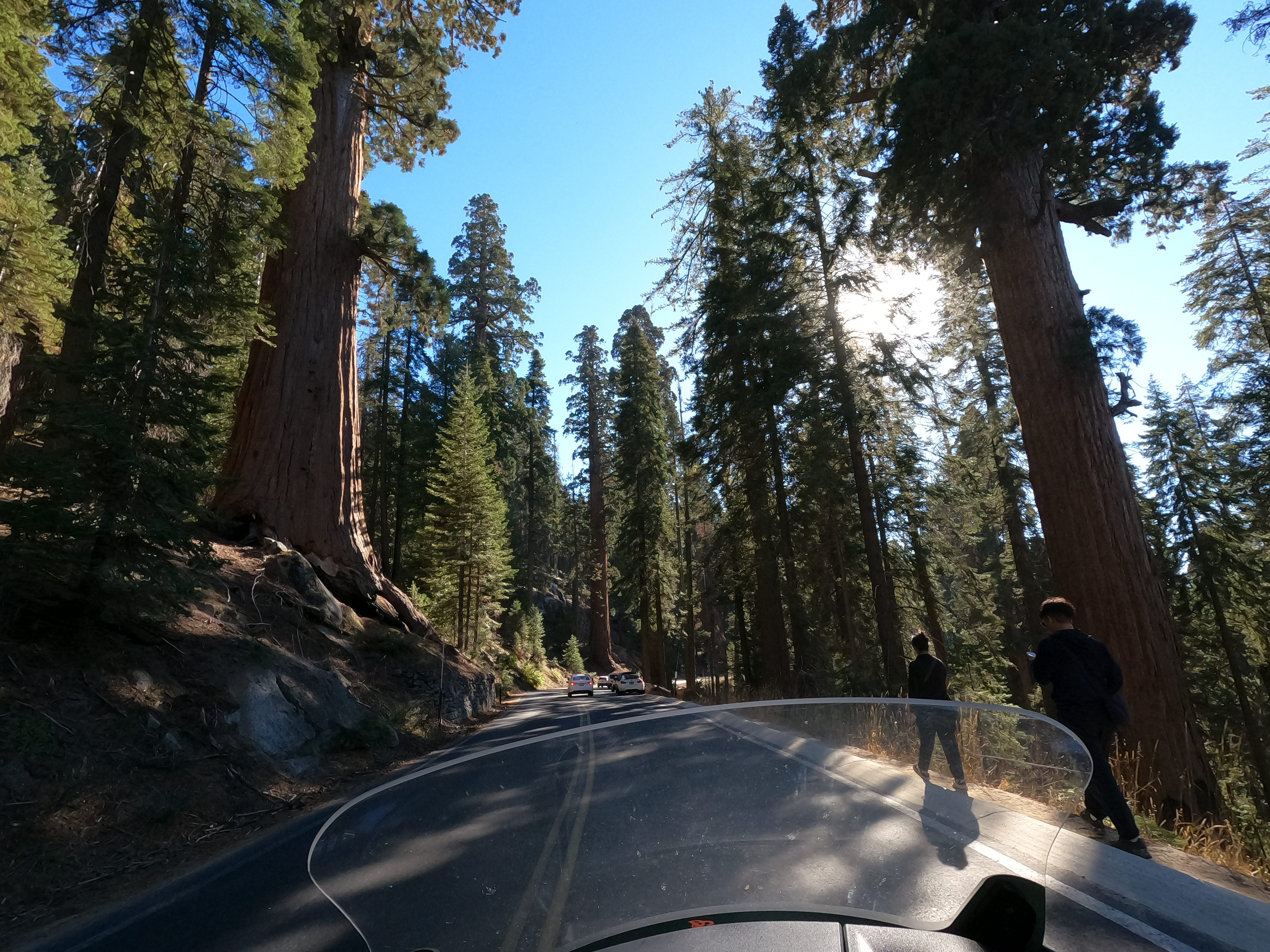
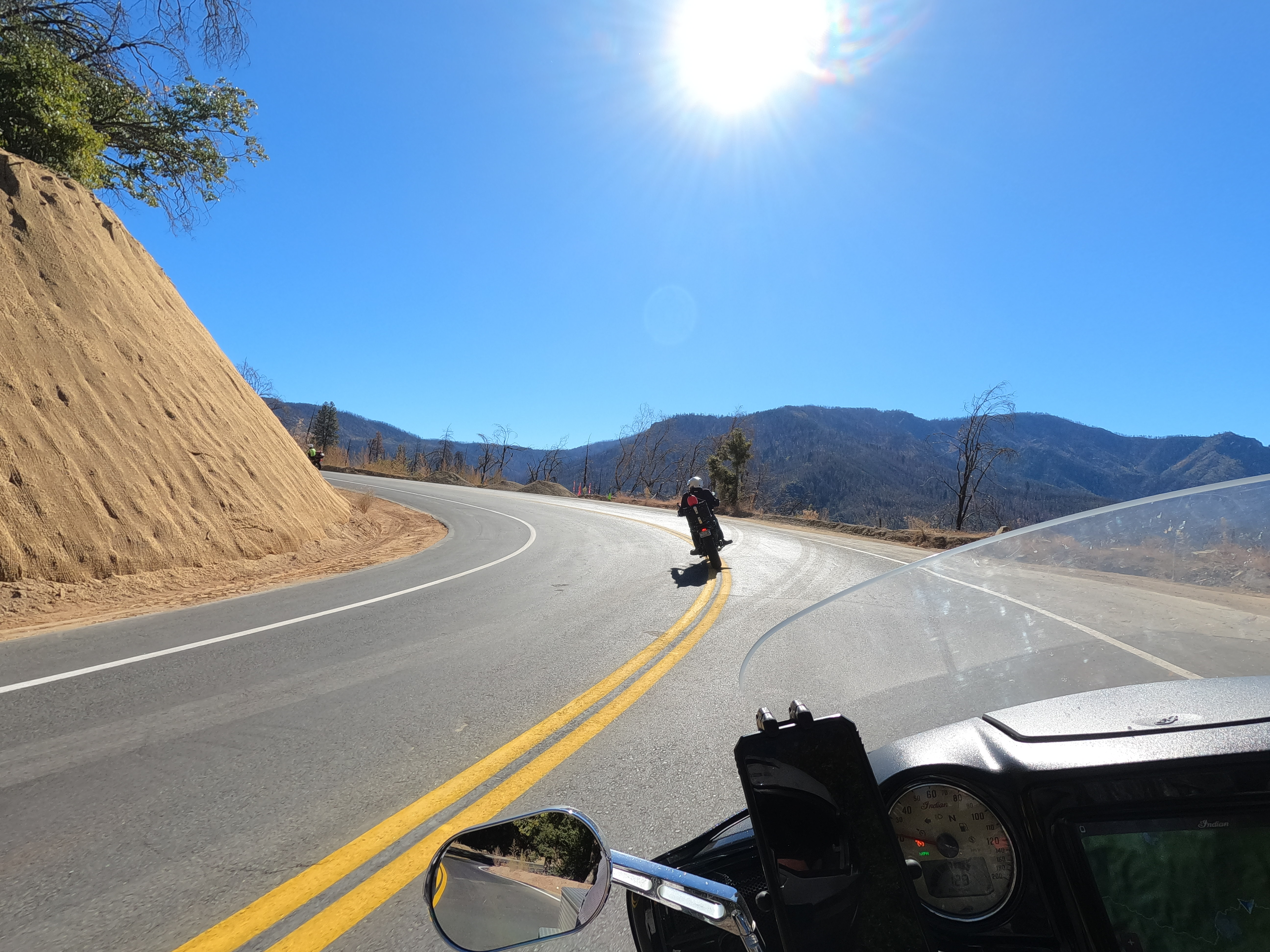
In the morning I was southbound again. I saw plenty of fire damage, but that also caused a lot of road repair, so the asphalt was smooth and the road markings new. Eventually though you get dumped into Fresno on Hwy 41, but Hwy 180 takes you out of that armpit and east to the Sequoia National Monument.
I’ve seen the redwoods plenty of times but — despite living pretty close for many years — I’ve never made it into Kings Canyon or the Sequoia’s (at least not the park bearing that name, clearly the trees grow outside the park too, so I’ve ridden among these giants before).
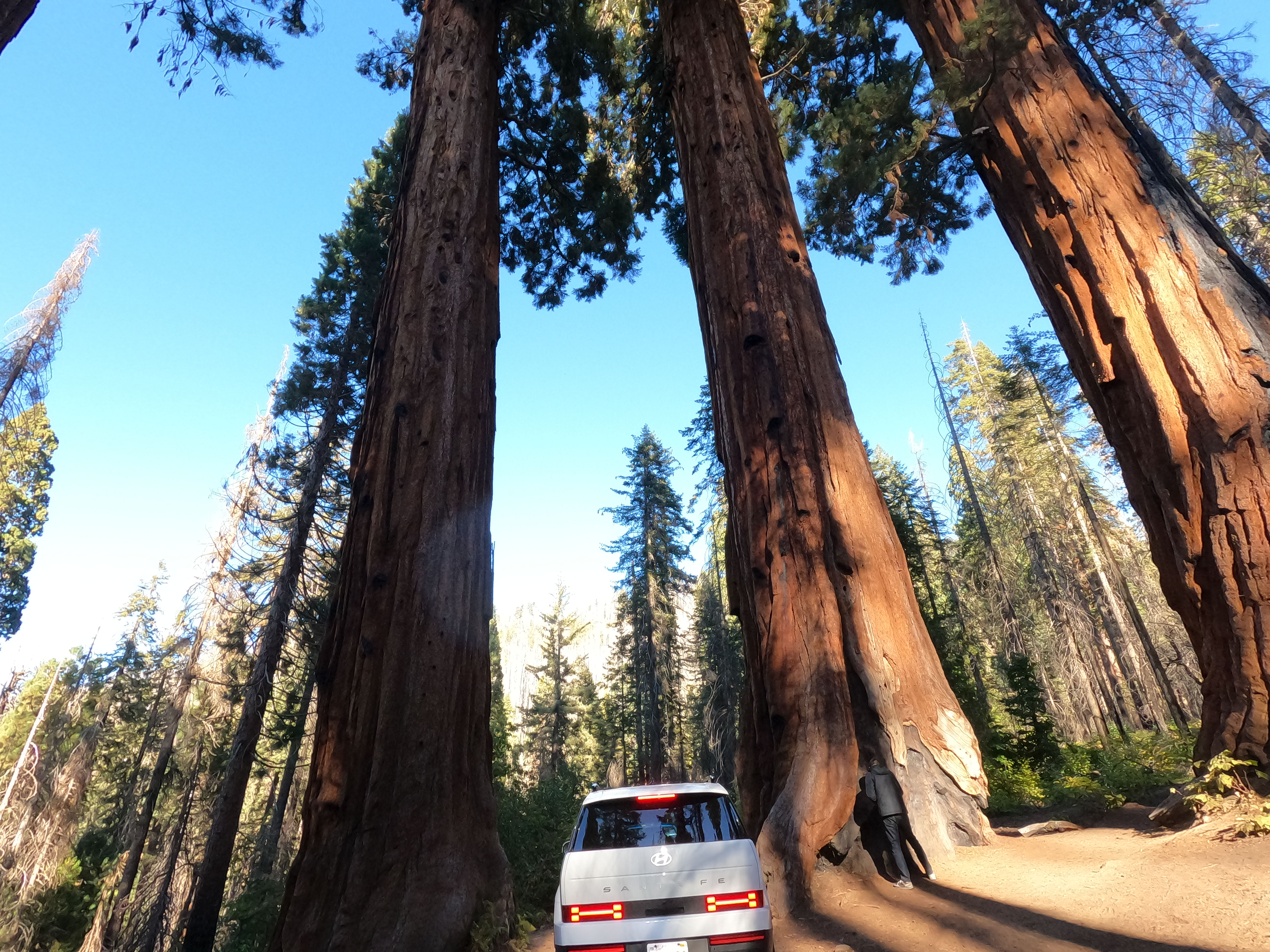
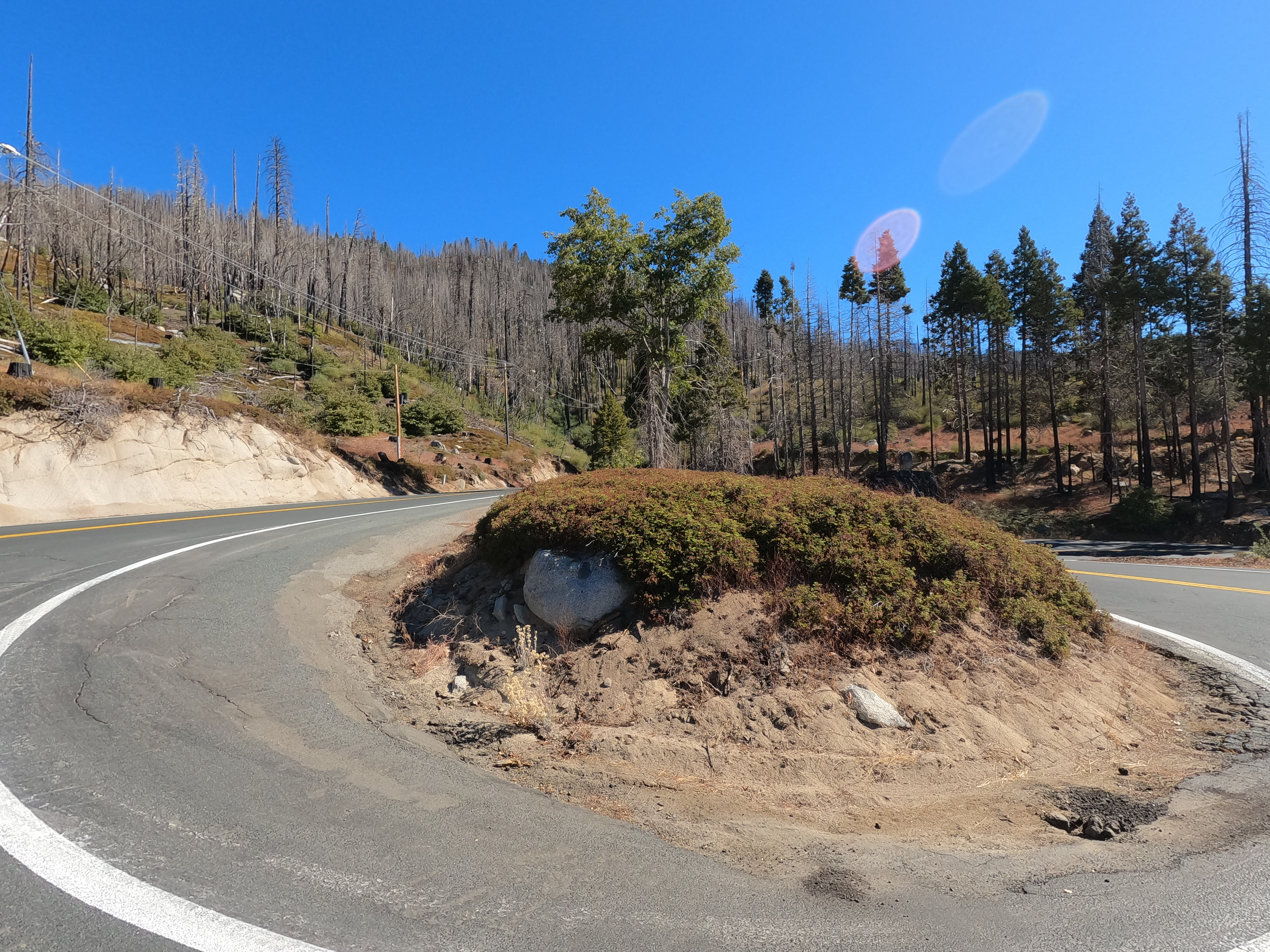
I didn’t get a decent picture of General Sherman — the largest tree in the world by volume. It’s a mighty fine tree, but it didn’t blow my mind like Lonely Doug up on Vancouver Island. Sherman is biggest by volume, so there are taller trees immediately around it and trees that are wider at the base. The cool thing about these trees though is how long they live and how they survive forest fires. Most the old ones have big, charred furrows in their trunks from long ago fires.
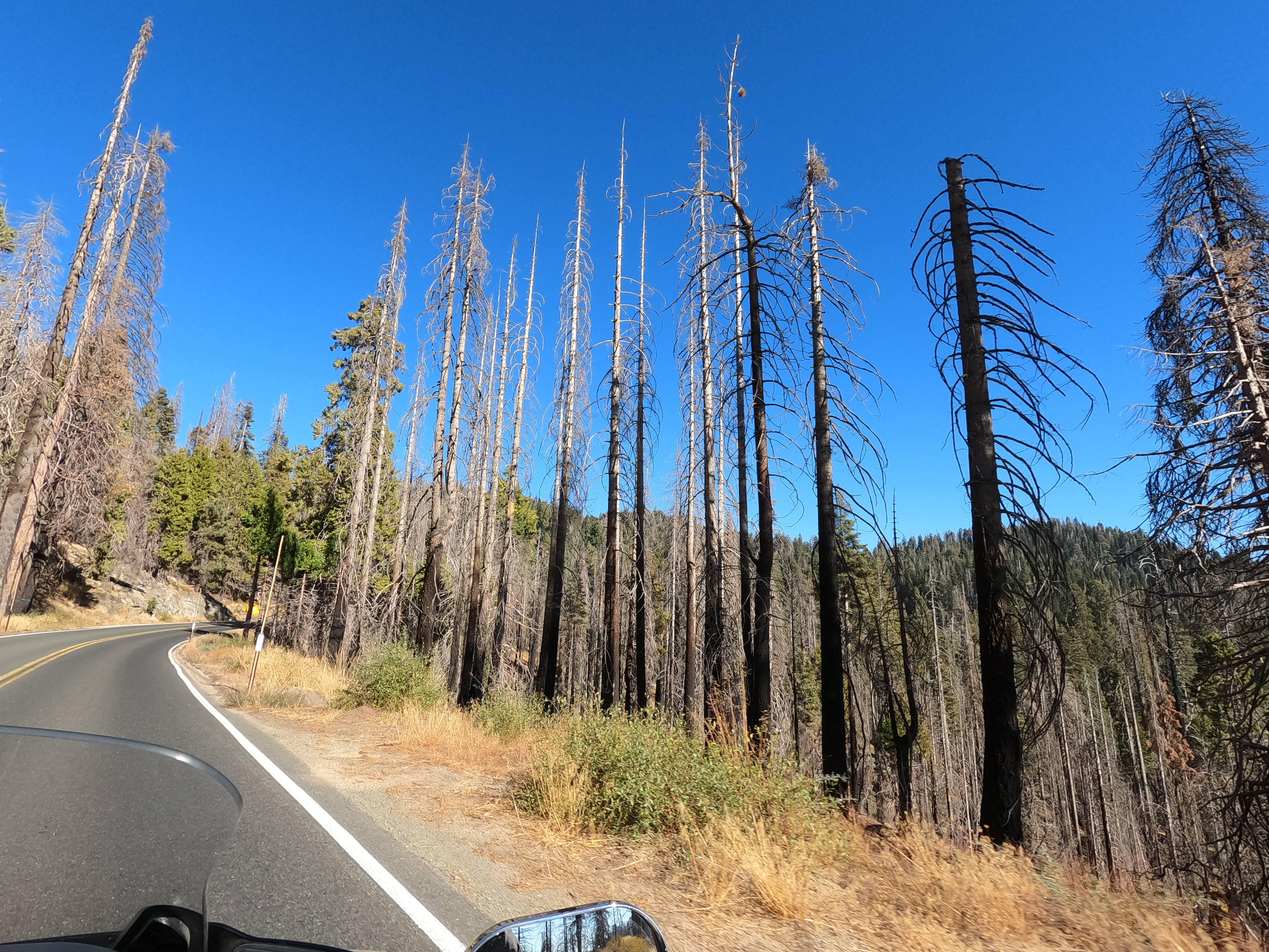 The sequoias may grow big enough to survive a forest fire, but other trees don’t.
The road is twisty and moves through beautiful country, but eventually plops you back out on the central valley and into Visalia. More straight roads lead you down to Porterville on Hwy 190, where I grabbed a cheap campground at Lake Success. It seemed an overly optimistic name, being a reservoir in Brown-Town, full of a few fields and a lot of poor grazing land.
The campground was well built but still stuck in a hot, dry, and somewhat featureless area of low hills, but it was $10. No one was there to pay it, and no envelopes were there to leave a check, and there was no cell service to use the website. I posted up at a random spot and ate a gas station burrito before drifting off.
Kings Canyon
In the morning a Park Ranger came a knockin’, looking for the $10 I didn’t pay them. Fortunately the guy wasn’t a dick, because if you aren’t going to take cash and you aren’t going to have someone there to take my payment…
I already see the day in the near-future where I’m looked at as a grumpy old fart for expecting to be able to pay for something by giving a person money. And yet, reality beckons. If you don’t have wifi, how do you book online? If you don’t have wifi, how does a person take my credit card payment on-site?
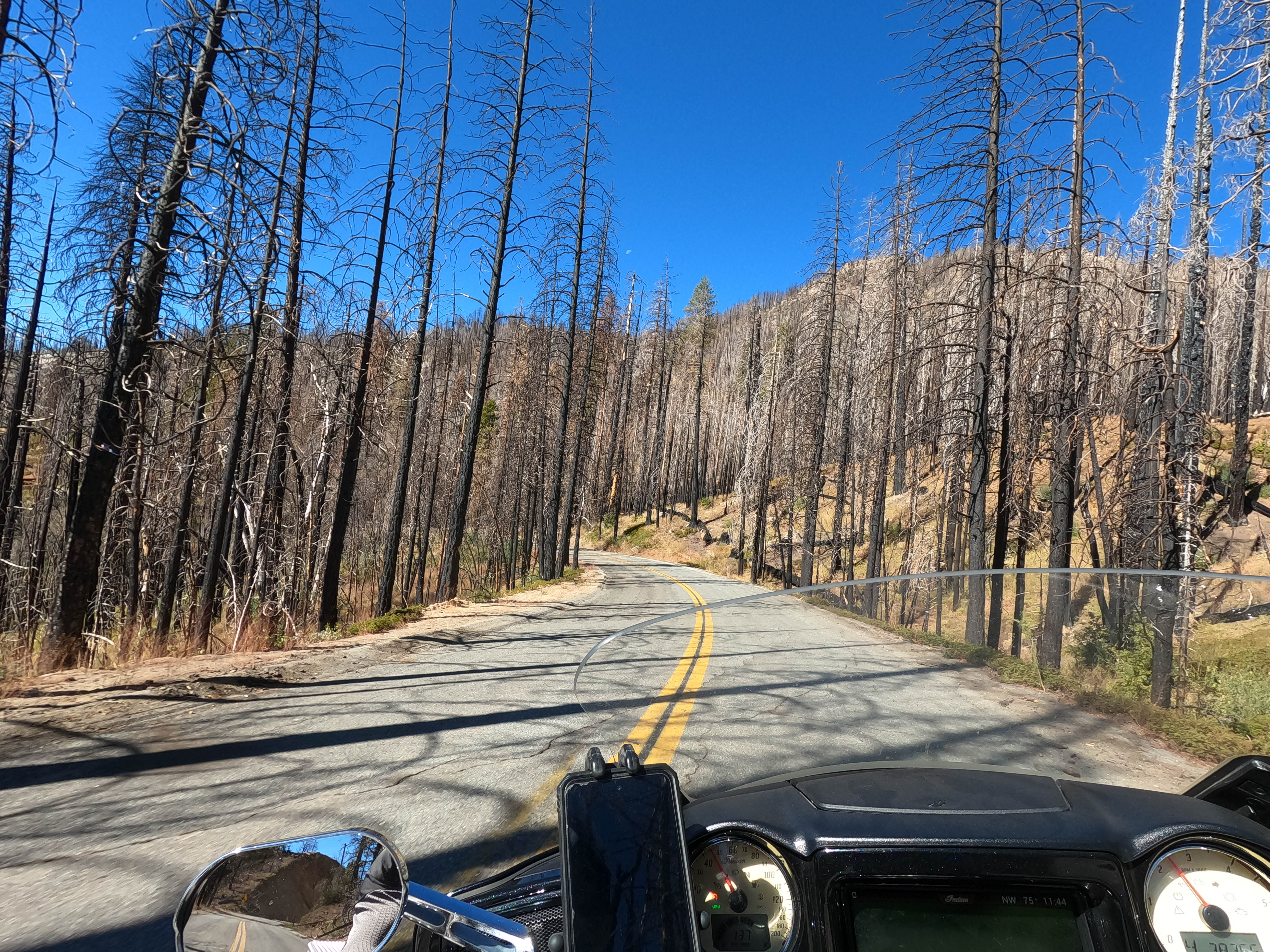
I drank the last of my instant coffee while debating if we really are descending into an idiocracy or it’s just me, then packed up camp and continued east on Hwy 190. This area also had fires that wiped things out, meaning the pavement and markings were new, along with the shoulder work. In fact, work continued at several spots where drainage had to be routed under the roadway.
Some road closures piled me in with traffic, but the worker running traffic was letting motorcycles to the front. I still did get stuck behind two guys going kind of slow though. They were on Yamaha TW200’s and on a decent-length ride based on the extra fuel and gear they were carrying.
The main problem for me was one of them kept entering every corner too early, then had to scrub speed through the corner, past the apex, and run wide on the exit. That had me unable to pass anywhere since he was wide on the exits, where I would initiate a pass. Eventually they seemed to figure things out and used a turn-out to let me past.
After that there was a huge amount of empty road. Even oncoming traffic was almost zero. I felt totally alone, in a good way. The park was not as dramatic as Sequoia to the north, but I was happy to have so much brand-new road to myself; this was my version of Disneyland. The only problem was signs telling me the road was closed. Google Maps disagreed, but I generally trust my eyes over an app. I wasn’t turning back until I hit a gate though.
And sure enough I did find a gate, but it was open. Even though it is the same road physically — without any intersecting road — Hwy 190 was now “Great Western Divide Highway.” Sure. Okay. Eventually it meets up with Mountain 50 (M-50) and continues toward Kernville. Working downhill, the devastation from the fires increases, with more loose scree on the road and more patched up pavement. The huge stands of dead trees also open up the view, making the scale of devastation more visually stirring.
You eventually merge with the Kern River and follow it into town. I grabbed gas and lunch, then dropped some postcards in the mail before letting out a sigh; it was time to drop down into the desert.
I was reluctant to leave because this is familiar territory. If you look at a map and find Kernville and Victorville they might look far apart, but I lived in Victorville for over seven years so I know much of the area — and especially the paved roads — between the two. The Mojave desert is downright exotic to most people. It’s an alien terrain and home of everything from Death Valley and mining ghost towns to secretive X-plane crash sites and spacecraft development. To me, it’s just a lot of sand and low-rent human beings.
Not to say I don’t appreciate the desert, but having lived there for so long I learned to look closely to see the hidden beauty the desert offers. Now, I’ve seen it. It’s just hot and sandy, bereft of shade, and I’ve been to a bunch of the cool little towns or dive bars and mom & pop restaurants. Without an off-road machine there isn’t new stuff I want to see.
Also there weren’t really any more destinations on my list for the whole 2024 trip. I was on my way to Bisbee to kind of close it all out. I did decide to stop in Joshua Tree National Park because — believe it or not — I’d never been there. I’d been along the highway above it through 29 Palms multiple times, and to the south is I-10, which of course I’ve been on countless times, but people raved about the park itself.
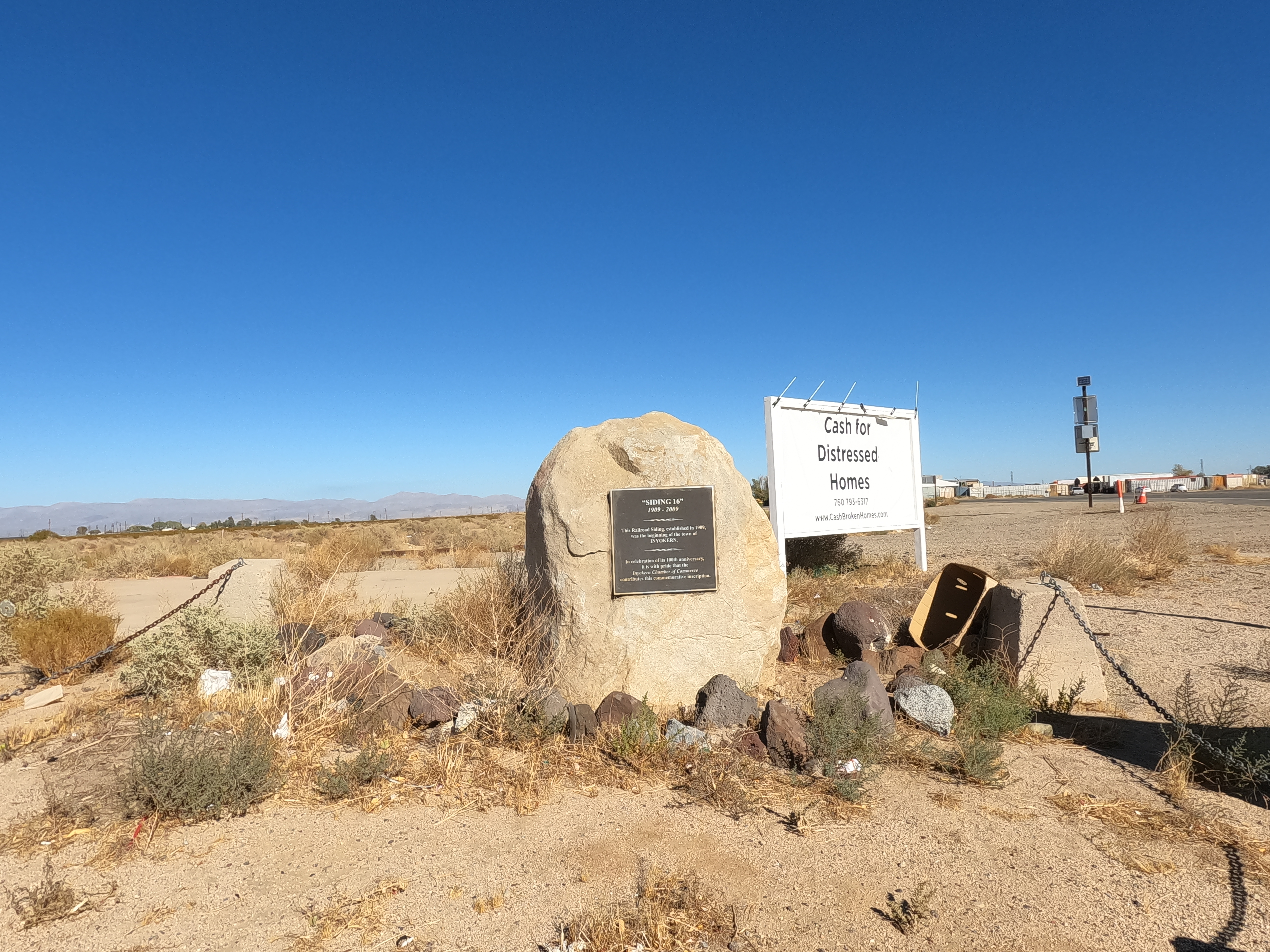
After passing Lake Isabella I resigned myself to a slog through the heat, but there were still some great canyon views and old farmsteads for the first part of Hwy 178. A quick run north on 14 lets you hook over to Hwy 395 at Inyoken, which basically came into existence because there was a railroad spur there. The only reason it still exists is probably because of the highway junction, so I hope “Inyoken” is Indian for “only exists because of intersection.”
But hey, the gas was kind of cheap for such a remote area of California.
I’ll tell you here & now that Hwy 395 is a good one, but like any long route, it has good and bad sections. I have ridden it from its southern terminus to Reno MANY times, and up to Alturas at least once. Living in Victorville, I used the section between there and Kramer Junction about a bazillion times. It is very straight, mostly flat,and repeats itself more than a drunk guy with a concussion.
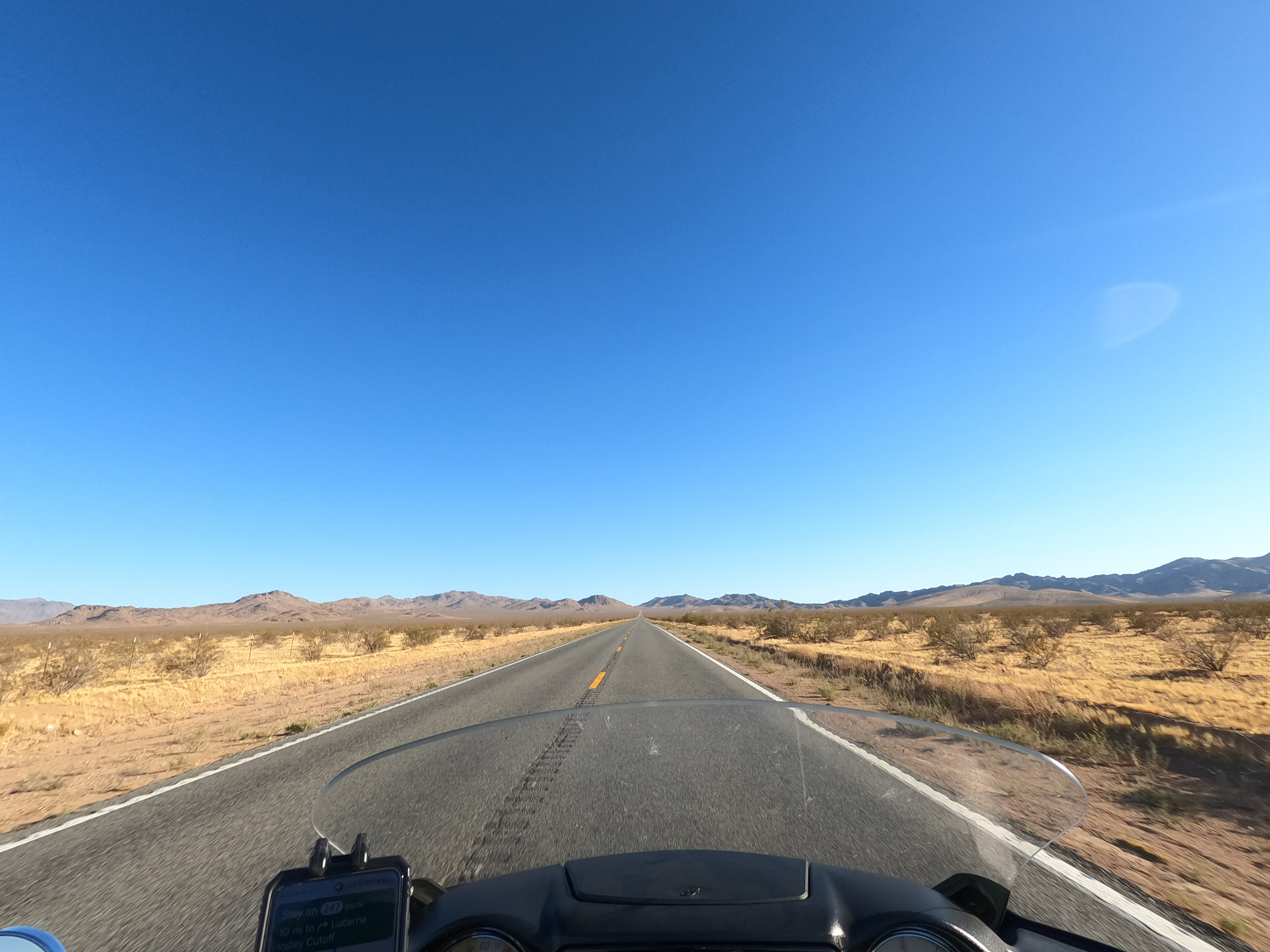
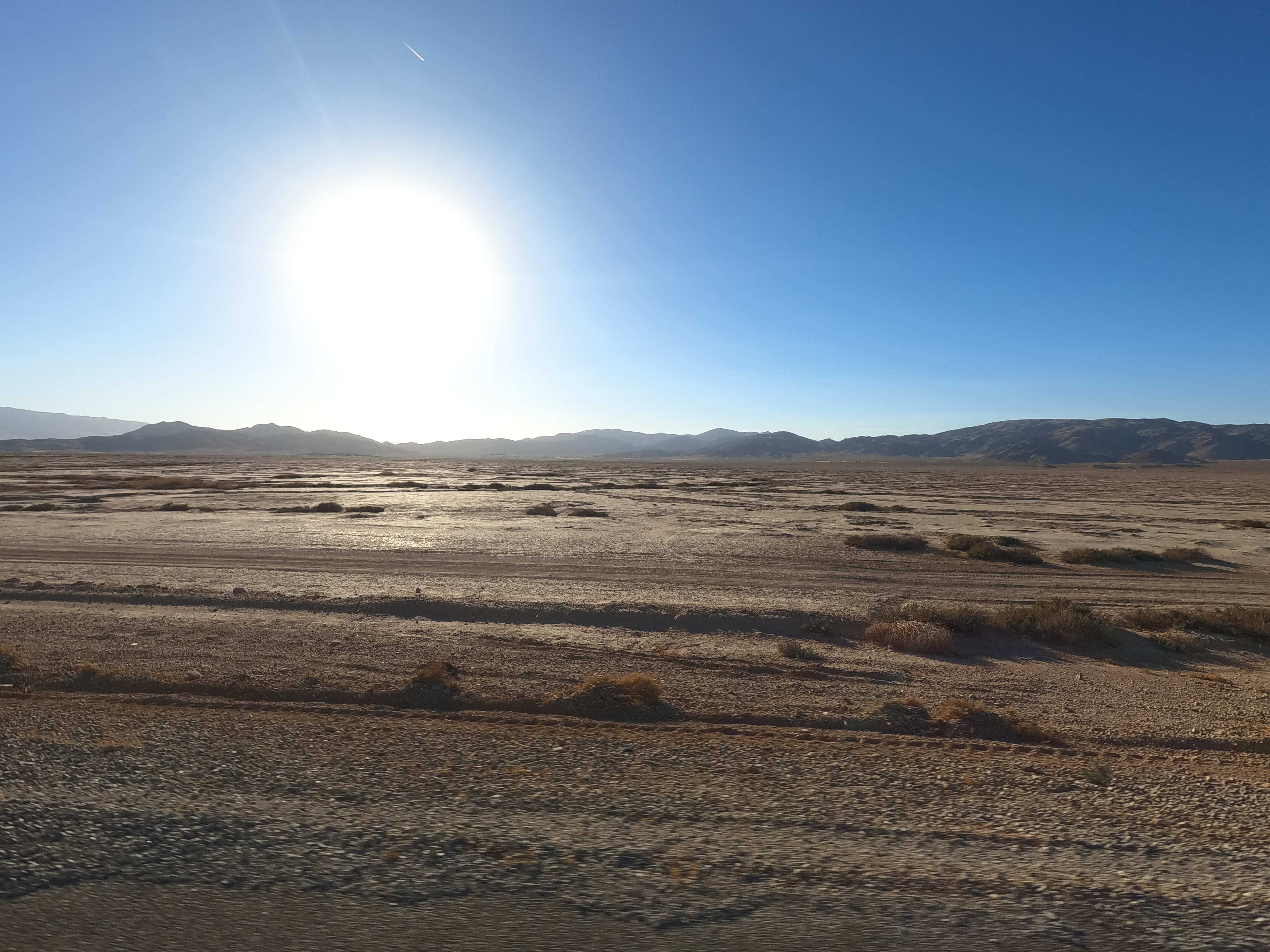
The barrenness is exotic and unique, but I’m the wrong guy to try and wax poetic about it after the years of living in it. I’m sure I could if you were paying me, but this is free, so gawk at the pictures and use your imagination. On the plus side, there were no vicious crosswinds.
I slogged down to Kramer Junction, which has had a kind of bypass for many years now. New gas stations are trying to pop up where Hwy 58 shoots over 395 now, instead of the traffic light and railroad crossing that used to back up for over a mile.
From there it was Hwy 58 East to Barstow, a town which also lives on only because it is a rail junction and you gotta get gas somewhere, so highways have always gone there: it’s the only thing in the area. Another junction town. From there you should take I-15 south, but that means going to Victorville, and, just…no.
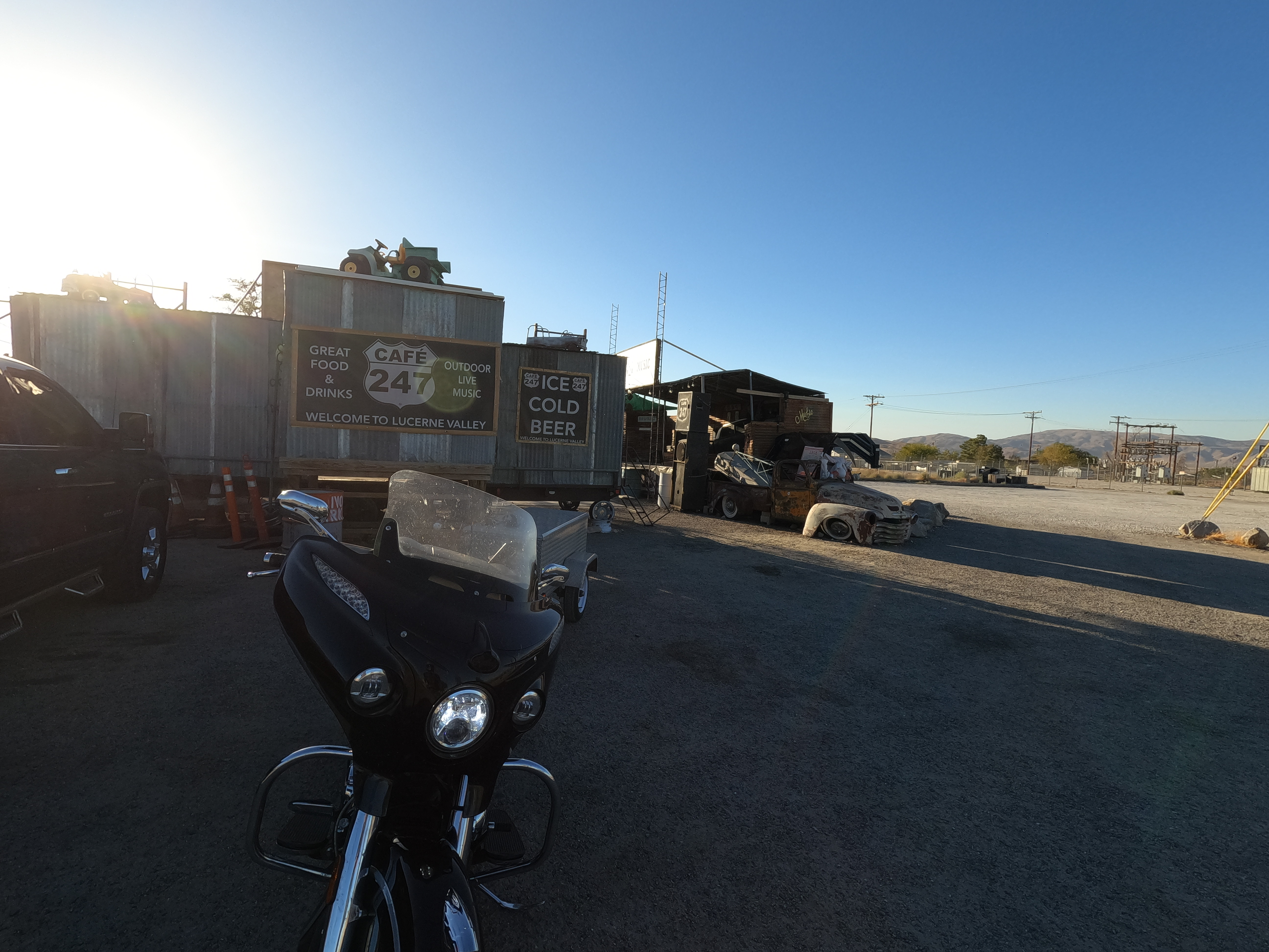
Instead I grabbed Hwy 247 to take the back way down to 29 Palms and J-Tree. That takes you through some great areas for off-roading, but meh for a guy on a 2-wheeled RV. Eventually you hit Lucerne Valley. It basically exists because there were some springs there, and the pioneers started pushing the natives out in the 1870’s. Eventually it was the site of the final battle of the Indian Wars (like 10 places claim the distinction) when some renegade Indians got hunted down and forced onto a Rez.
Other than that, people grew alfalfa there for awhile, but I’ve never seen a field in cultivation, so I have no idea how the town is still alive other than– you guessed it — a junction between Hwy 18 and 247.
It’s a chicken-egg thing though if you think about it. Junctions end up at places because it was worth building a road through the area. That means there had to be a reason for people to be in the area in the first place: people first, roads later. However, it still seems that once you get two roads through your area, it does more than just double a town’s chances of survival.
Into the desert center
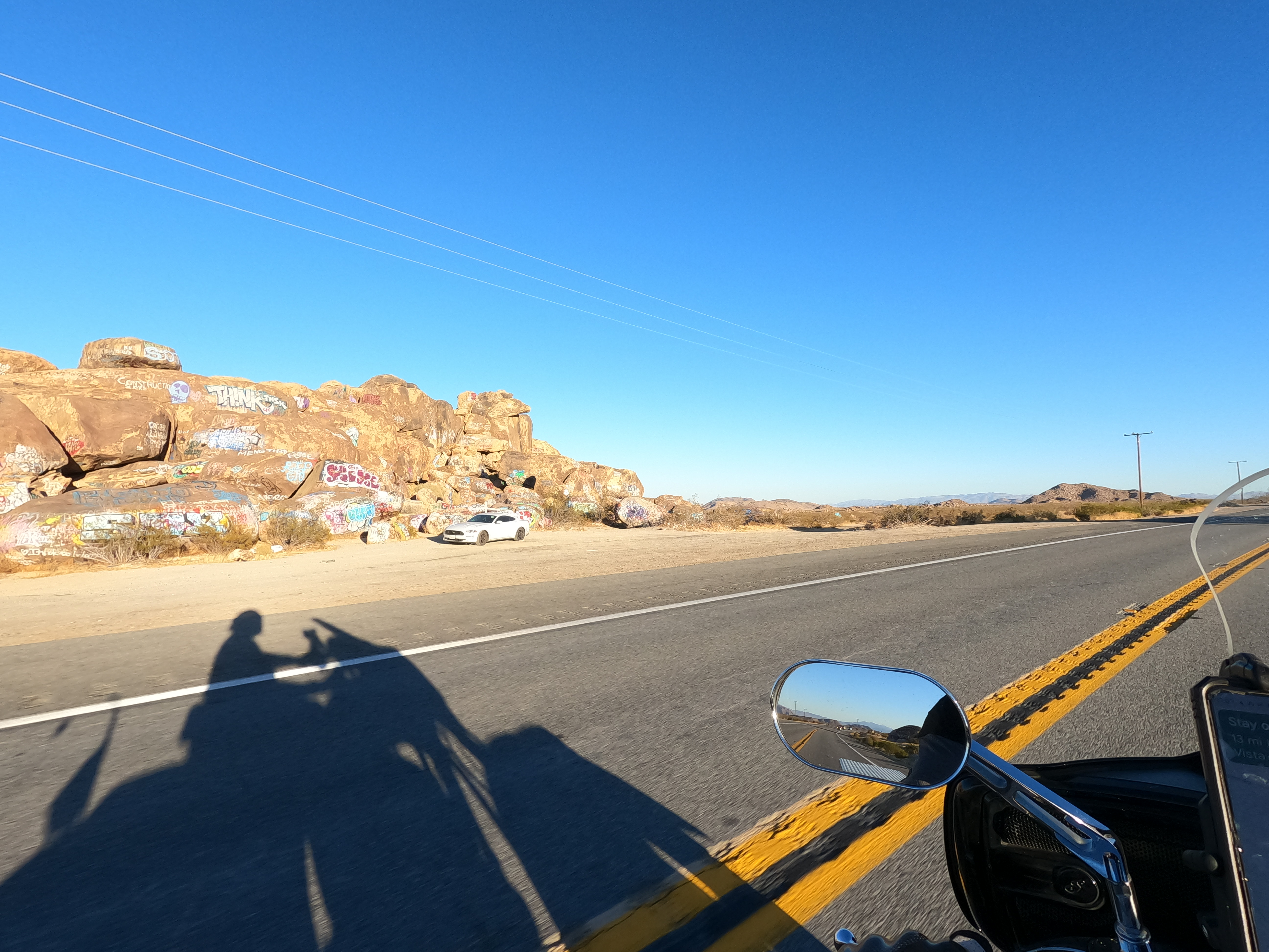
Still on 247 you now head east into Johnson Valley, known to me only because of an OHV park. However, there’s also some painted rocks (literally, graffiti). I remember a 10-day meditation retreat in 29 Palms I attended, and afterwards I stopped there and saw someone had scrawled “Live Fast” on a rock. It stood out because of how 10-days of non-stop meditation can warp your sense of time. Life is already fast, but our sense of it changes based on our surroundings and our thoughts.
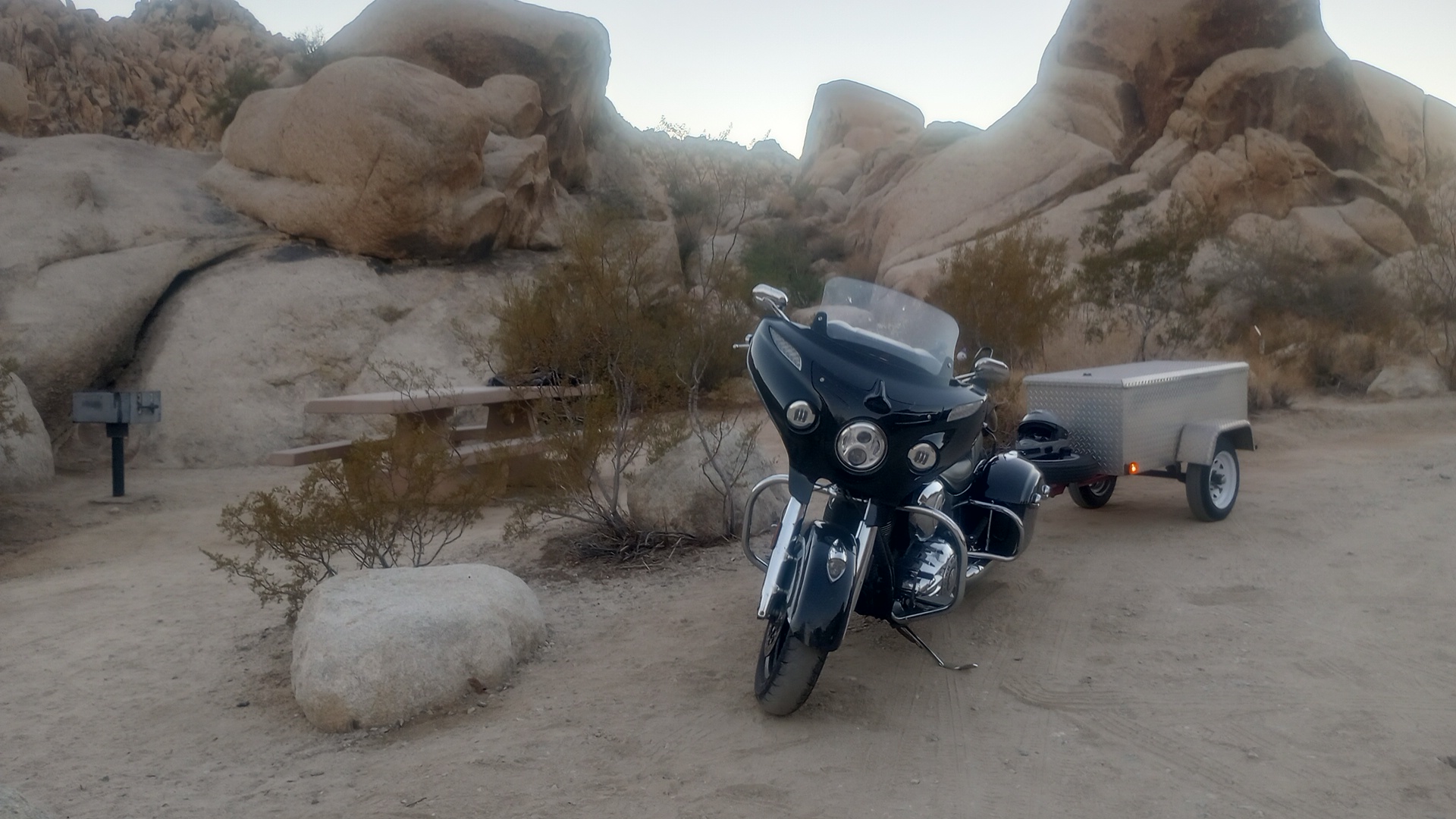
Once into 29 Palms I found a campground that was pretty empty and enjoyed a lot of stars. This town owes its existence to an oasis, which happened to have 29 palm trees growing around it when a survey crew came through.. There are probably less than that now; the town still exists because of the J-Tree National Park and NTC, the National Training Center. That’s fancy-talk for “there is so much nothingness out here we can do war games without worrying about our tanks and trucks wiping out a bunch of habitat.”
I slept well, that’s for sure. The sun had really worn me out, and the repetition and familiarity of the area had really put me into a melancholy. Or, not even that; it was a sort of nothingness. Just, “meh.” In the morning I would make my way through J-Tree and to I-10, which would be even more of a slog. I wasn’t too excited, but I did find a thing or two to enjoy… more on that later, as I bring ‘er on home.
Got any desert stories from the Mojave or Sonoran desert? Share them in the comments.
