Already March. So much the same, so much different. The good news for me is that Bisbee offers far more to do than San Felipe, so there is far less of that Groundhog Day repeating — the blurring of days and constant malaise. Also, the Mexican border is close so delicious tacos abound.
The monotony of being in one place is starting to build, which is usually when I start pulling out maps and dreaming up a trip for the coming summer. Oddly, I’ve spent equal times looking at places to go and places to stay. While I’m still not excited about buying a house and settling in somewhere, I also don’t feel wondrous about riding around looking at stuff. It comes back to a central theme for me: purpose and meaning.
I generally sum purpose up as long-term meaning, and keep the definition of meaning rather loose. You know it when you feel it. We look externally for something with meaning, trying to find our purpose. Of course, meaning is an emotion, and all emotions are generated from within. Still, there’s nothing wrong with looking for outside stimuli to spark a reaction, causing us to “find” meaning.
If you know it’s an externality that sparked meaning, but isn’t meaning itself, you’re pretty damned lucky.
I had a purpose of simply exploring: going around and learning, exchanging ideas, gathering knowledge and experience. But, like many things, the ever-present “why” crops up. Experience for the sake of experience? There is something powerful in that if you study Far Eastern philosophy. Taken too far though, it becomes a death sentence.
Observing the world without judgement is not the same as living a life devoid of meaning. Meditating and practicing mindfulness is not a life: it’s a practice to deepen our understanding of being alive. It’s still up to us to get out there and live. So why exactly is riding around on a motorcycle and looking at things “being alive?”
Without a sense of meaning, it isn’t living. Anything can become a prison, even something as literal as going out and experiencing life. Hard to wrap your head around, right? Now you know why I drink.
Doing the things
Lately I have struggled with this circular logic, but I did manage to get out on the bike and clear my head a bit. While out on a ride with a few acquaintances I met someone who also owned a DR650 Suzuki like mine, and liked taking rides out on the trails. We set up a ride and went out into the Huachuca Mountains. It was just me and my new riding buddy, who is conveniently also named John.
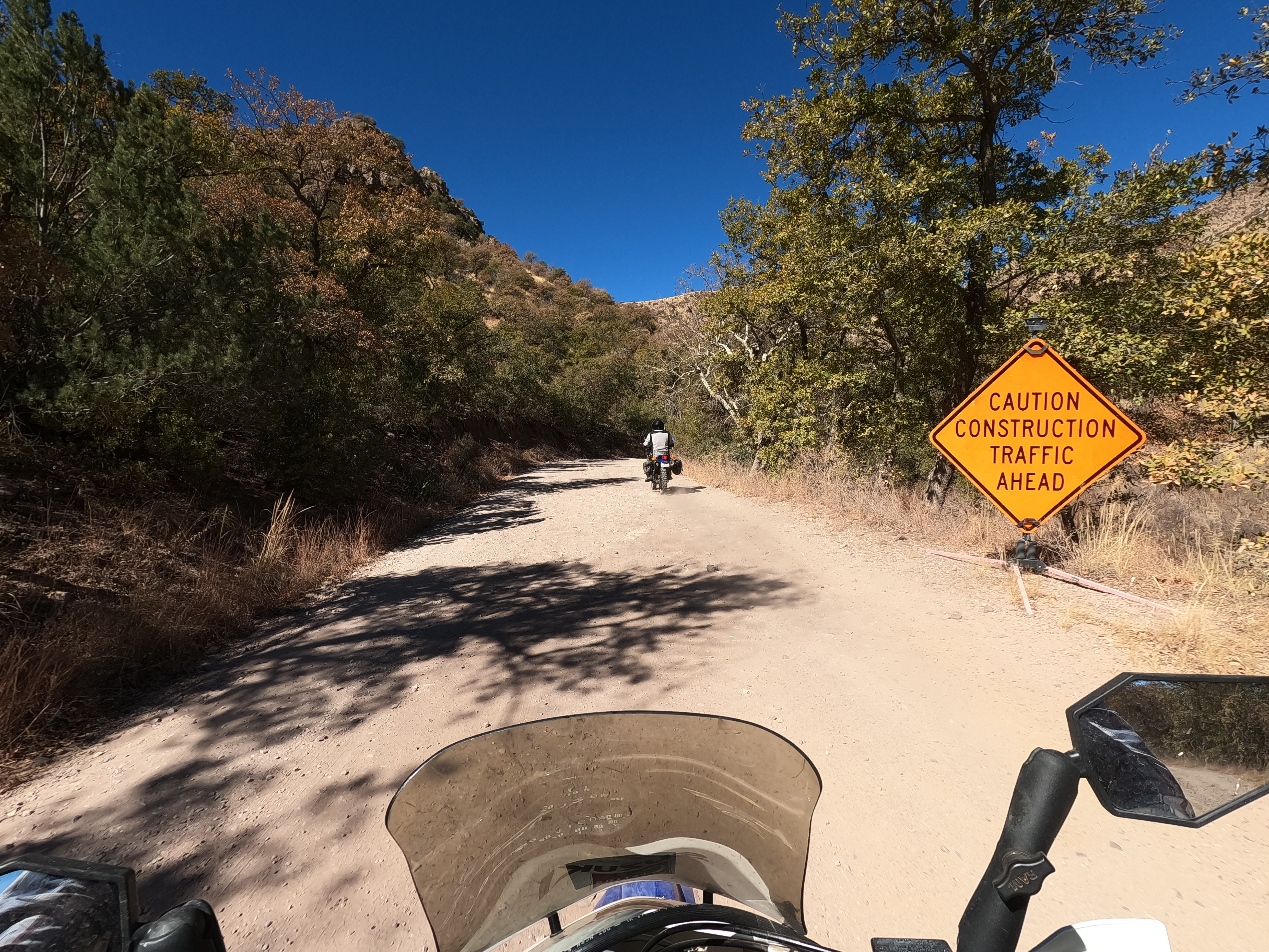
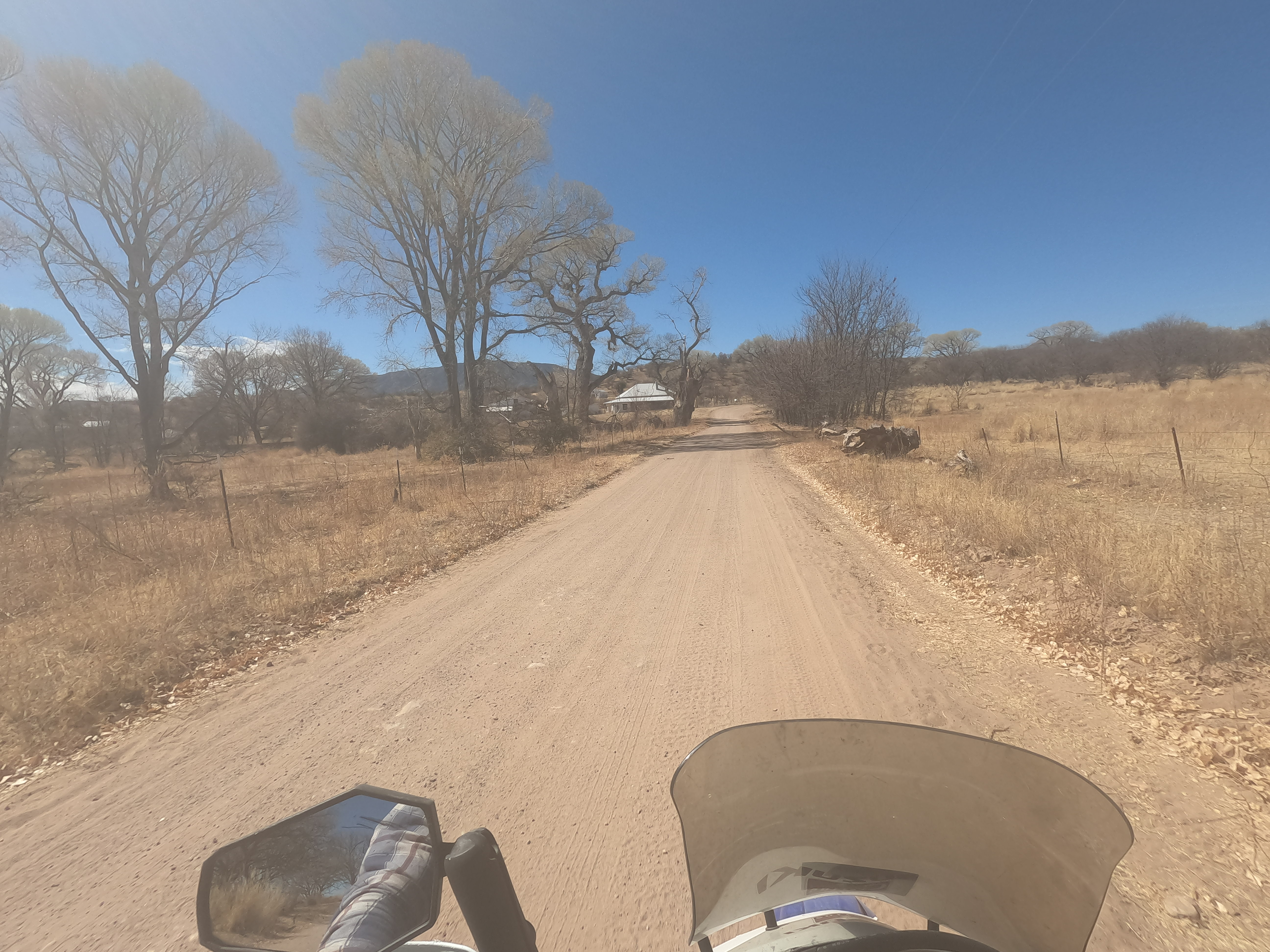
Maintenance was ongoing out there on the dirt roads but there was quite a bit of washboard from car traffic, as this winter has been mild and more people are outdoors. Add to it that we entered the mountains on the most popular road (into the Coronado National Memorial and into Montezuma Canyon) and there’s going to be a fair amount of traffic.
It’s still way easier than driving on highways and dealing with the road-zombies that plague our nation. People on dirt roads generally don’t careen around blind curves because there could just as easily by a road-grader as someone on a motorcycle. This and the lower over all traffic and you have a recipe for relaxing the mind.
Better still though it striking the balance, where the brain must be present to its environment. You don’t want to be overwhelmed like driving in the rain on a crowded interstate, but if you can stay just the right amount of focused, you be present in the moment (mindfulness) without being stressed out and mentally exhausted (or terribly bored and daydreaming, which is definitely not mindfulness).
Dodging rocks and patches of sand and pot holes can give you that right amount of focus, but still let you look around and engage with the natural world around you, and not just the road 50ft in front of you.
Eventually the roads get better simply because you’ll get over the first range of mountains and into the Coronado National Forest. Not only is there USDA money for the roads, but there are still a lot of cattle ranchers operating in the area, as well as the Border Patrol needing access to nearly every canyon that could mask smugglers.
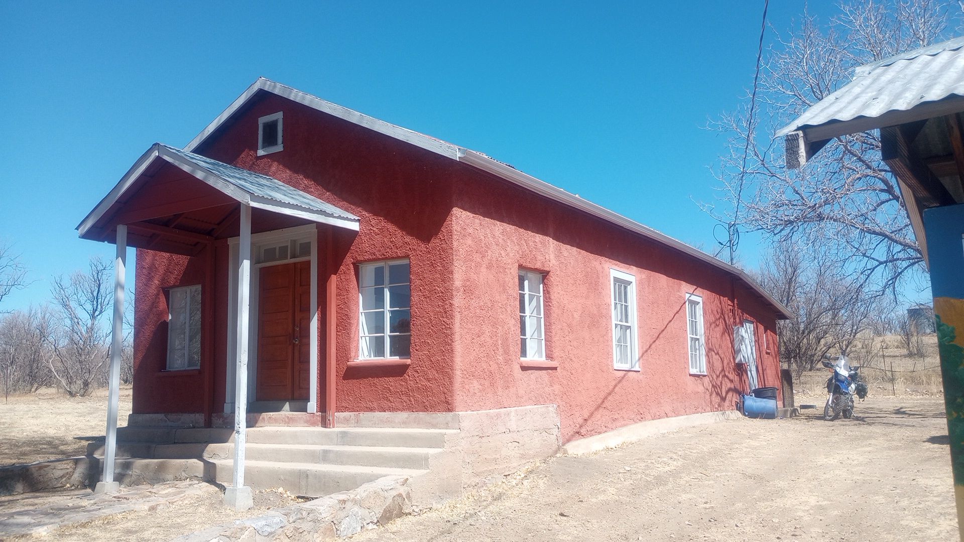
The Forest Road south still serves several ranches, though most are abandoned except for the wind-powered pumps and water basins for cattle. At least one ranch house appeared occupied, and several still had mailboxes. These were mostly ranch homes that sprouted up a town called Lochiel, which still has a few inhabitants.
It was mainly settled by Mexican ranchers until mining brought American settlers and a smelter was set up to serve the mines. The town had about 400 people in the 1870’s when the land was surveys. Turns out the town straddled the US-Mexico border so it was divided and a US Customs house was built.
Several buildings remain, though most look more from the 1950’s to 1970’s in their current state. The land was privately owned until about 1998 and some of the properties are still private. There’s a restored one-room adobe schoolhouse with interpretive signs of the local history. There’s also an old church and cemetery, though it is fenced off.
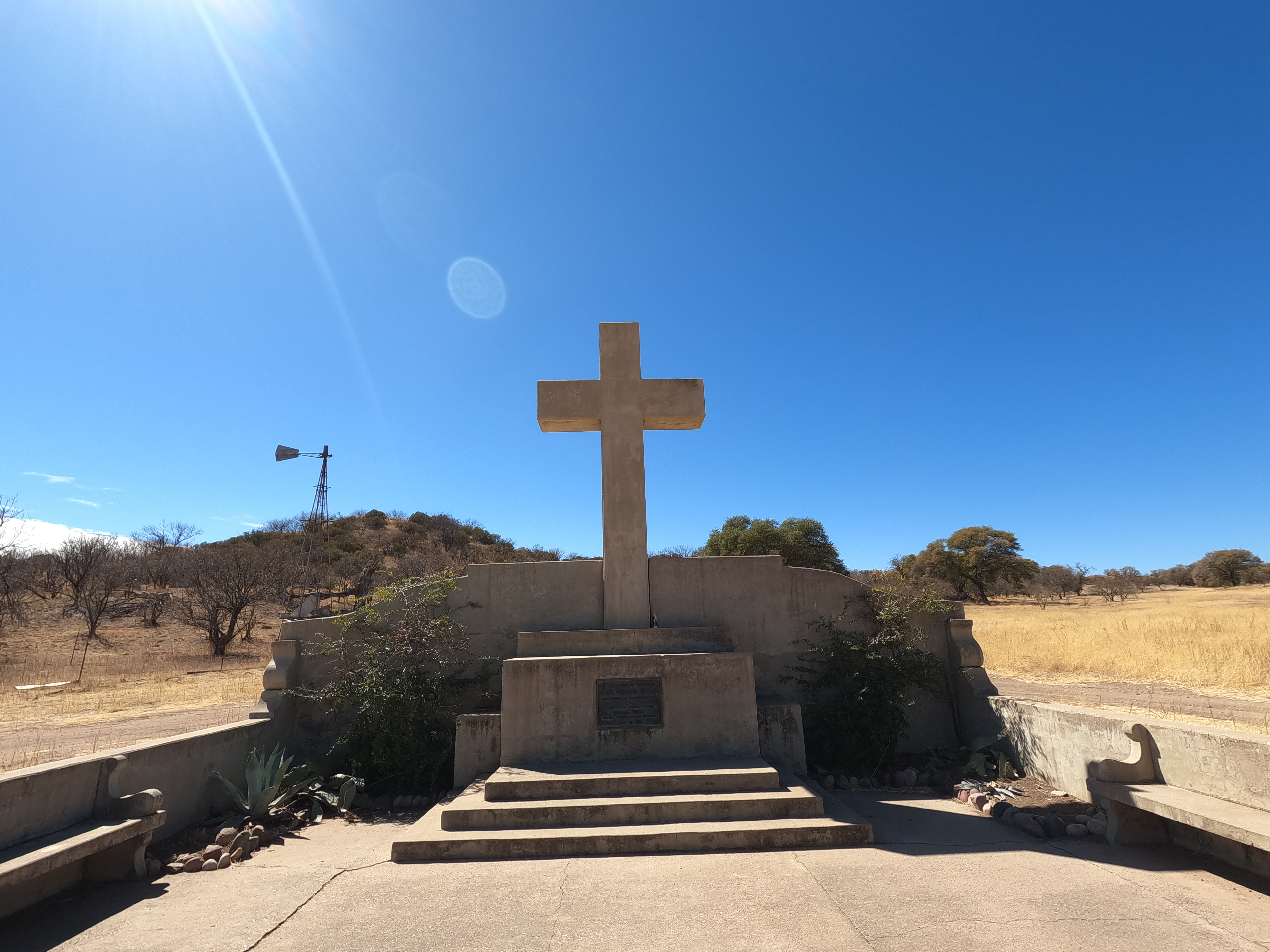
Less than a mile away is a large concrete cross and marker that proclaims it is the first spot that European settlers entered Arizona, when Spanish missionaries passed through in the 1500’s. It’s very hard to understand in modern times why this place became so popular, as it is so far from current civilization, but time has a way of blurring perceptions.
I’ve seen many an abandoned roadway that looked difficult to cut into a hillside, but if I look at the current highway next to it I can see why no one would try to cut and level it by hand; the original location makes more sense when everyone moved at walking speed.
Patagonia
Further west we began climbing the Patagonia Mountains. I didn’t understand why someone would cut a trail though such a steep range, but I’ll guess that it was an important connection between Lochiel and Nogales, which would probably have been the closest large city. John and I also came across evidence of mining operations, clearly from the 19th century based on the large, square-head nails still holding together collapsing wooden hoppers.
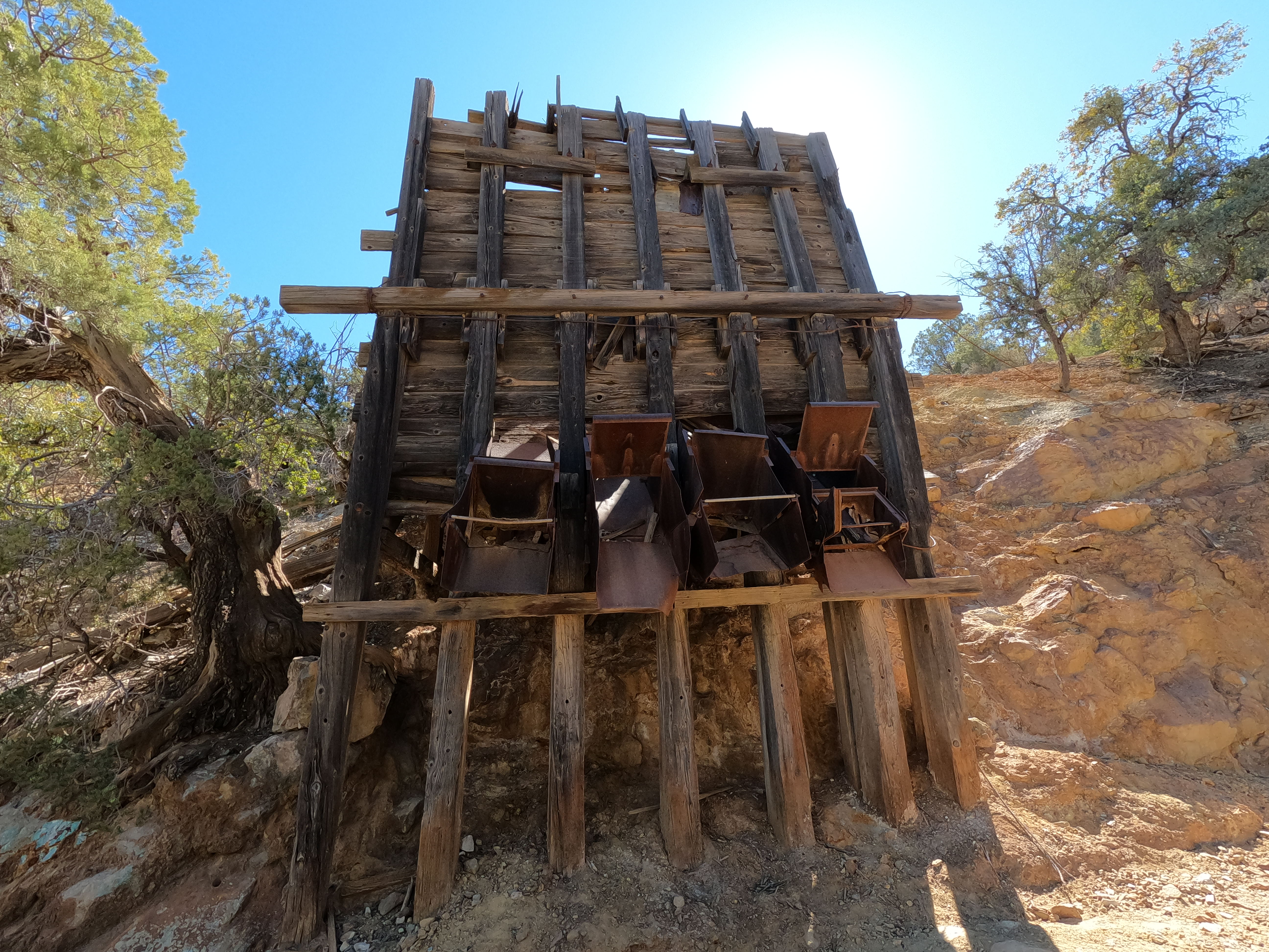
Usually, on the worst 4×4 trails, you’ll find old tailings or cables from mines, so it has become my default answer to “why would anyone build a road out here?” You can either say “mining” or “money” since the one leads to the other. We hit one such spot as we cut north toward Patagonia. It was extremely rough, rutted, and narrow. No way a horse team could have navigated it.
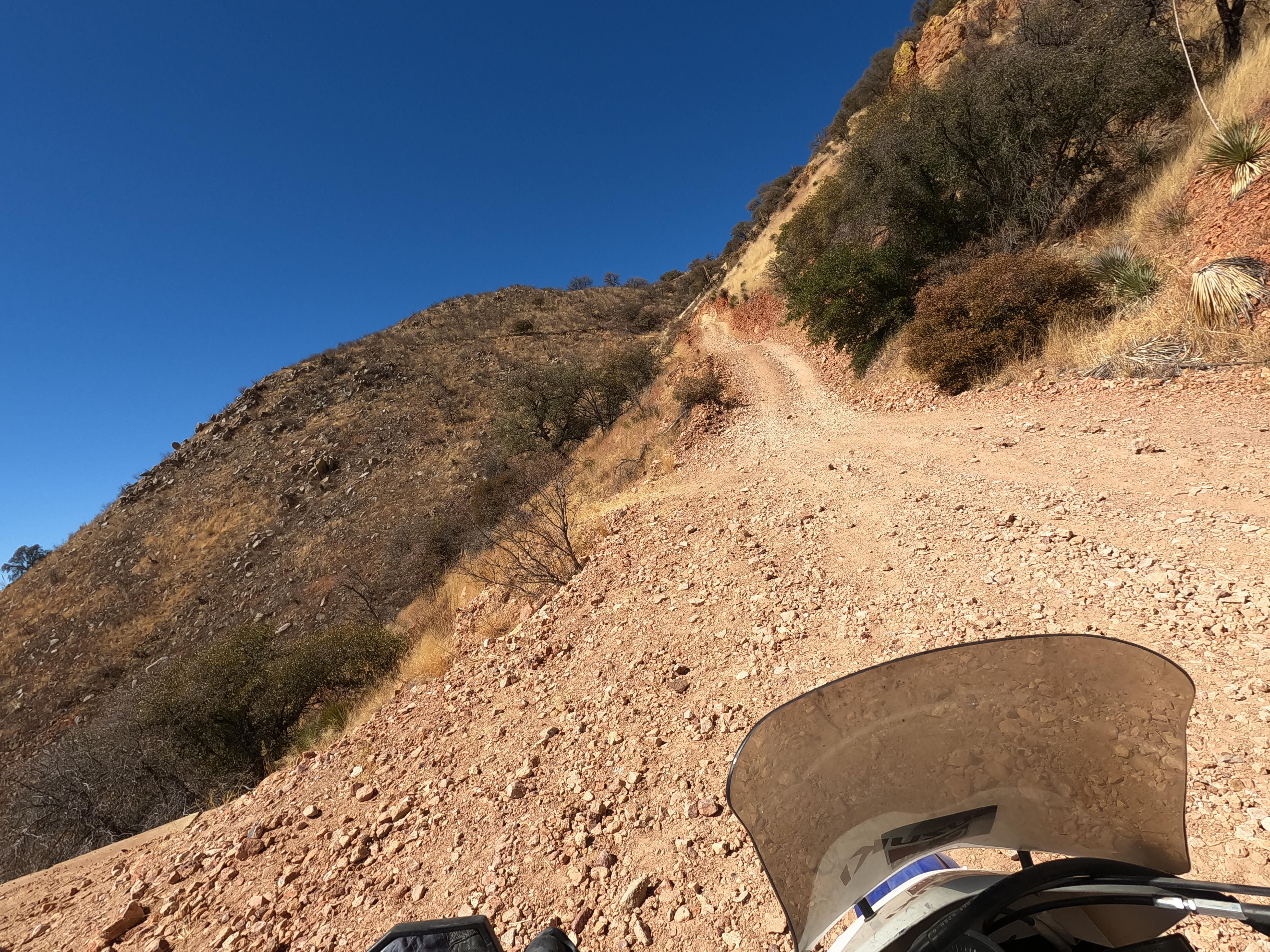
About a half-mile up was a flat space with some concrete slabs that may have once held a tower for cable ore carts. There was no evidence left though and steel cabled that long and heavy are almost always abandoned in place. I was more focused with huffing and puffing my way up the trail and doing my best to stay out of ruts and rills.
Loose rock, switchback turns, vertigo-inducing curves…now we’re having fun. The good news was both I and John made it up without falling, and though we needed to stop and catch our breath, it would have been foolish not to stop and take in the view when there was an occasional flat spot.
At the top there is an open hunting area with dispersed camping, so we had to ride slowly to make sure we were actually on the trail and not riding in circles between camps. We guessed right and made it to Harshaw Road, which was unpaved but in excellent shape. It continued to get better until we reached an old mine that was just coming back into operation.
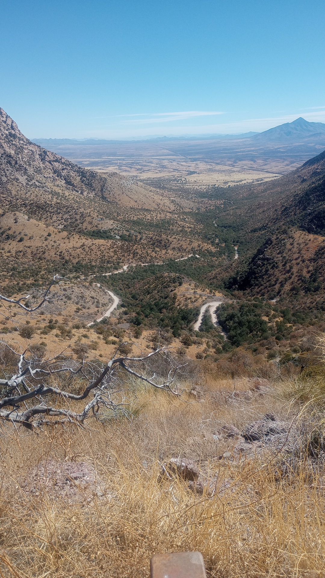
 From the beginning of the ride once we got to the first pass, looking back east at the lower desert and the winding trail we had just climbed.
From what I could see it looked like an abandoned landfill: a large mound with uniform slops and flats, expanding out almost like a lazy pharaoh’s dirt pyramid. One possibility is these were mine tailings, piled up and left after processing. Either technology improves or the price of some mineral goes up, and now it’s worth going back and reprocessing the abandoned tailings.
Either way, it was worth large buildings being constructed on-site, yet there was a stream of brand new dump trucks coming and going too. It wasn’t worth much consideration and I returned my mind to its meditative state until I spotted an old cemetery just across a stream.
I’m glad I stopped as there were a few stories. The oldest death date was 1899, there newest was 2018, and the site looked entirely unorganized even today. There were rows in a sense, but it was more an attempt to keep a family together, or because there was some flat ground. Climbing up the hillside I found several piles of stoned with either no marker or just the upright of what was probably once a wooden cross.
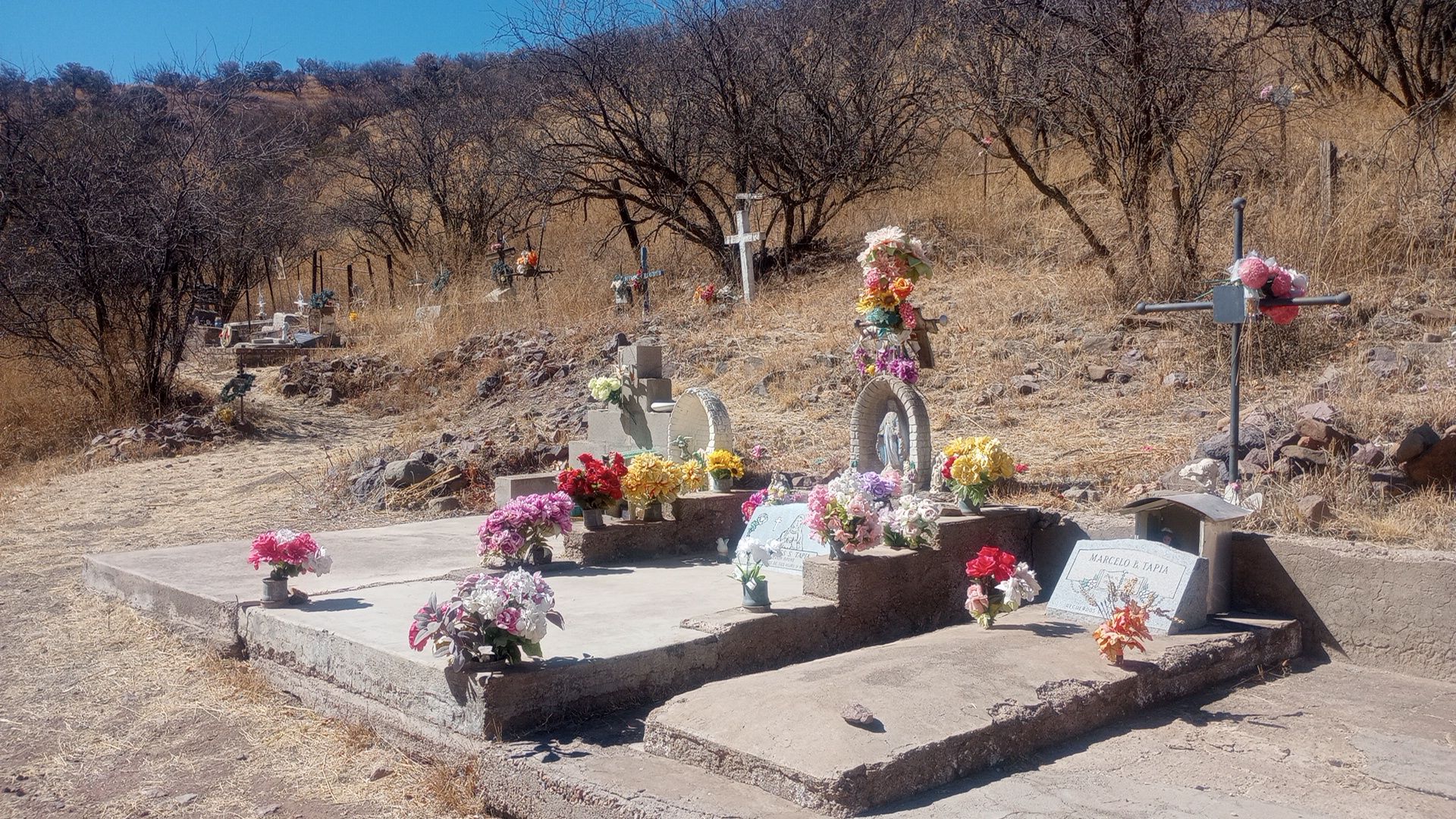
Many graves had a 2nd marker to identify the deceased, with the original marker still attempting to bear witness to a life lived, or not lived, as there were several children who died between seven months and two years old. One man’s story was written out on faded paper. He went to a mine to sell a cow but found it already butchered. An argument likely ensued and he was murdered, his killers fleeing to Mexico. He left behind a wife and eight children, several who were buried alongside him.
He died in 1900.
From here the road was very good, likely because the mine was maintaining it. It was quite close to Patagonia, which survives mainly because it is on Highway 82 and is the only town serving off-roaders, outdoorsmen, and cattle ranchers. With the mine in operation though, they likely had a new source of income, as the city looked to be about 50% brand new, white work trucks. Some were likely ranchers, but most were probably mining company trucks.
John and I posted up at the Gathering Grounds, a sandwich and ice cream shop on the main drag. I grabbed a turkey ruben, which is great so long as you don’t expect an actual ruben. Fresh, filling, and with a side of pesto penne pasta salad (say it five times fast), I washed it down with a lemonade and reveled in the warm sun and cool air.
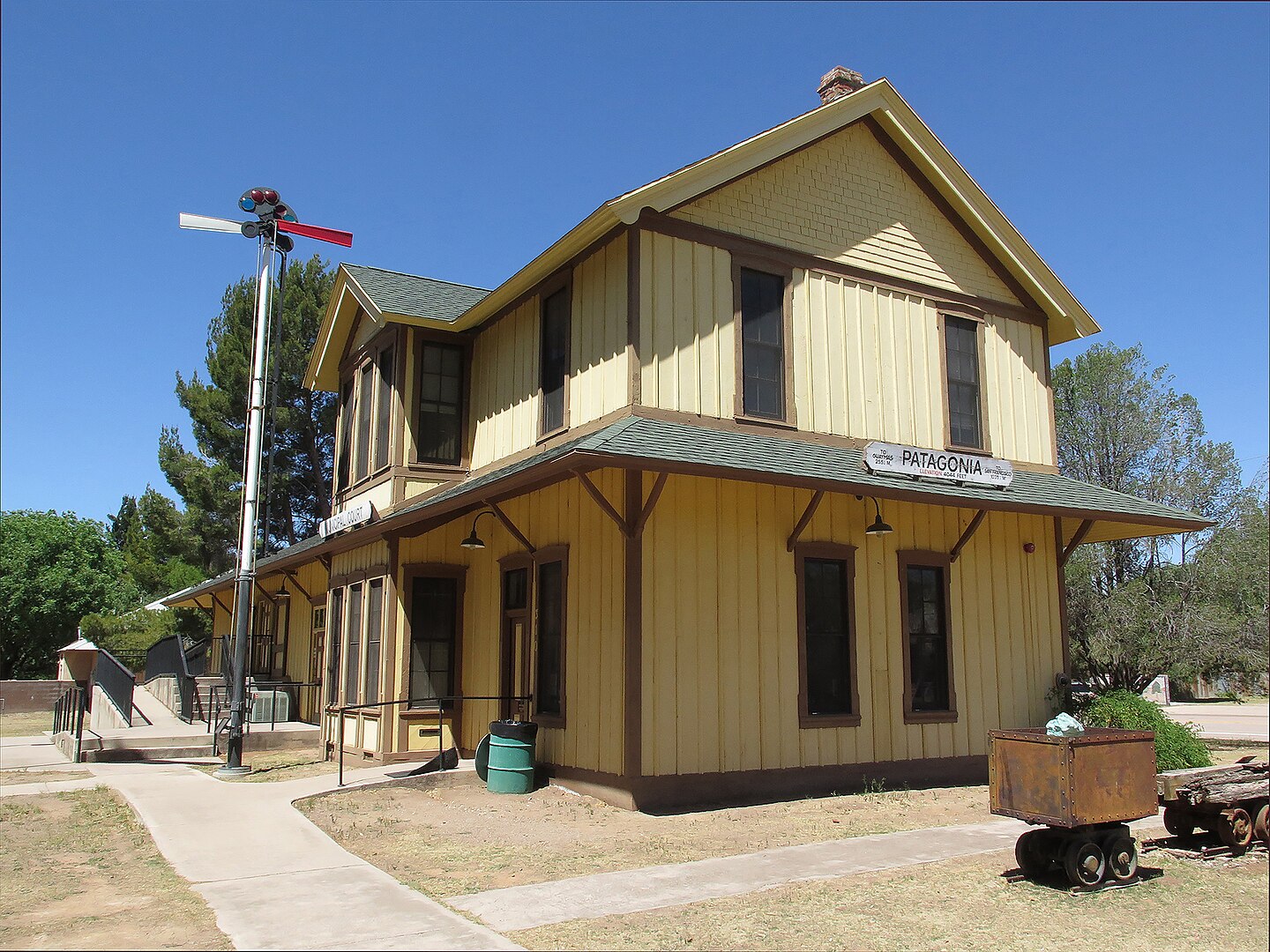
I’d love to have stayed longer, as there are many things to see in Patagonia, from a museum to a hummingbird park, to the old buildings on McKeown Rd, to the taco shop or old-time saloon. However, it was already mid-afternoon and we both wanted to take our time returning to Bisbee, as it was going to be straight and boring highway most of the trip.
The return route
This isn’t much to say, other than if you stop at every historical marker, you’ll learn a lot. I wasn’t ready for that but I did want to stop at Fort Buchanan, which was a slight disappointment. Now, I’m plenty used to old forts and ranches being nothing but the corner of two walls and some rotting timber, but there’s at least an interpretive sign and maybe even a reconstructed building.
Fort Buchanan had nothing but an old corral fence. In fact, the rough hewn logs were just held together with wire, and there were even some modern fences connected to it. A tiny snippet online says the fort was necessary because of an ongoing war with the Apache tribes in the area, and was eventually burned during an attack in 1865.
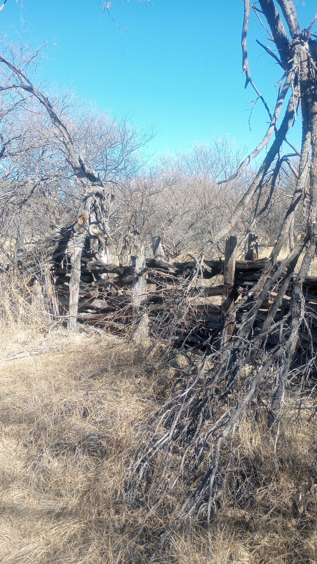
Less than a mile away another fort was constructed (Fort Crittenden), and there are a few rotting rail bridges over small gullies in the area, and even a few railroad ties in the ground. Other than that, there are some ranch homes, which explains the fencing connected to the original fort’s remains. Fort Crittenden at least gets a marker on the highway, but that fort’s crumbling adobe walls are on private property.
And that was about it. There are dozens of other historic sites we passed on the ride back to Bisbee, but we didn’t stop. There are preserved ghost towns, old battlegrounds, old mines and rail lines, and a lot of small military outposts that were used to protect miners and ranchers from attacks by the native tribes.
It’s a fine reason to own a motorcycle that can handle both highways and dirt trails, as much of the area’s history was bypassed when steam shovels or diesel powered equipment could straighten curves and flatten hills. With the constant moving of people and money in the 1800’s and early 1900’s, many of these items were abandoned only a few years after being built.
And so it goes
That’s it for story time though. I’ll head out and explore some of the old mines outside of Tombstone next week, so maybe I’ll have a few stories to tell and pictures to show. Being close to Tombstone usually means more people using the roads, but some of the mines were so small and produced so little silver that the road never became more than a single track horse trail.
That’s what John and I will be looking for, and then a late lunch in Tombstone most likely. It’s a tourist trap but that means there are a lot of restaurants in competition for tourist dollars, and a lot of good options. Tombstone itself it full of stories, but most have been told, and the once rough-and-tough Allen Street is a place to watch gunfight reenactments or buy some modern Western Wear.
In the mean time I’ll be staring at the ceiling and wondering where to travel and why I travel. Hopefully I get sick of it and have an “ah-ha” moment and break out the map book.
